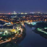
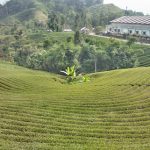
 Banten (Indonesia: Banten; Sundanese: ᮘᮔ᮪ᮒᮨᮔ᮪) is the westernmost province on the island of Java, in Indonesia. Its provincial capital city is Serang. The province borders West Java and the Special Capital Region of Jakarta to the east, the Java Sea to the north, the Indian Ocean to the south, and the Sunda Strait to the west, which separates Java from the neighbouring island of Sumatra. The population of Banten was officially estimated at 13,160,496 in the middle of 2020, up from over 10.6 million during the 2010 census.
Formerly part of the province of West Java, Banten became a separate province in 2000. The province is a transit corridor to the neighbouring Indonesian island of Sumatra. The Banten region is the homeland of the Sundanese Banten people (a subgroup of the Sundanese people) and has historically had a slightly different culture from the Sundanese people in the West Java region. In recent years, the northern half, particularly those areas near Jakarta and the Java Sea coast, have experienced rapid rises in population and urbanization, while the southern half, particularly that facing the Indian Ocean, maintains a more traditional character.
 Etymology
The name “Banten” turns out to have several possible origins. The first possible origins comes from the Sundanese phrase katiban inten, which means “struck down by diamonds”. The phrase comes from the history of the Bantenese people, who were originally animist, then embraced Buddhism or Hinduism. After Islam began to spread in Banten, the community began to recognize and embrace Islam. This spread of Islam in Banten is described as “struck down by diamonds”.
 Another story about the origin of the name “Banten” is when the Hindu God Batara Guru Jampang traveled from east to west, then arrived at a place called Surasowan (present-day Serang). When arriving in Surasowan, Batara Guru Jampang sits on a rock which is then called watu gilang. The stone was glowing, which was then presented to King Surasowan. It was told that Surasowan was surrounded by a clear river of water, as if this country was surrounded by stars. The place is described as a ring covered with diamonds (Sundanese: ban inten), which then evolved into the name “Banten”.
 Another possible origin is that “Banten” comes from the Indonesian word bantahan (rebuttal), because the local Bantenese people resisted to be subjected to regulations enacted by the Dutch colonial government at that time.
Apart from the story of the origin of the name “Banten” mentioned above, the word “Banten” apparently has appeared long before the establishment of the Banten Sultanate. This word is used to name a river, namely the Cibanten River.
 The higher plains on the edge of Cibanten River are called Cibanten Girang which is abbreviated as Banten Girang (Upper Banten). Based on the results of research conducted in Banten Girang, there have been settlements in this area since the 11-12th century.
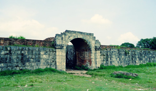
Even in the 16th century, this area developed rapidly. The development of settlements in Banten Girang extends towards Serang and towards the northern coast. The coastal area would later become the Sultanate of Banten which was founded by Sunan Gunung Jati. This Sultanate originally controlled almost all terriitory of the former Sunda Kingdom in West Java. But Sunda Kelapa or Batavia were captured by the Dutch, while Cirebon and the Parahiyangan region were captured by the Mataram Sultanate. The territory of the former Banten Sultanate was later converted to a residentie (residency) by the Dutch.


 Geography
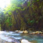
Banten lies between 5°7’50” and 7°1’11” south latitude and 105°1’11” and 106°7’12” east longitude. The province has an area of 9,662.92 km².
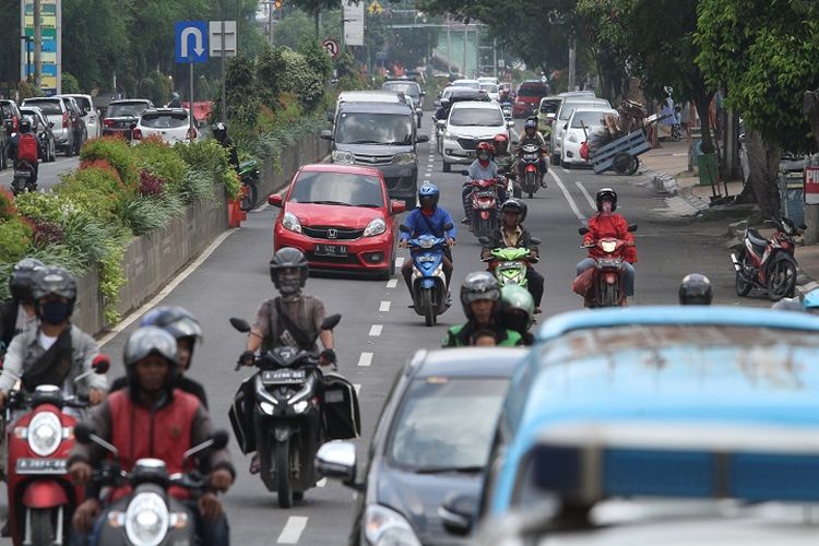
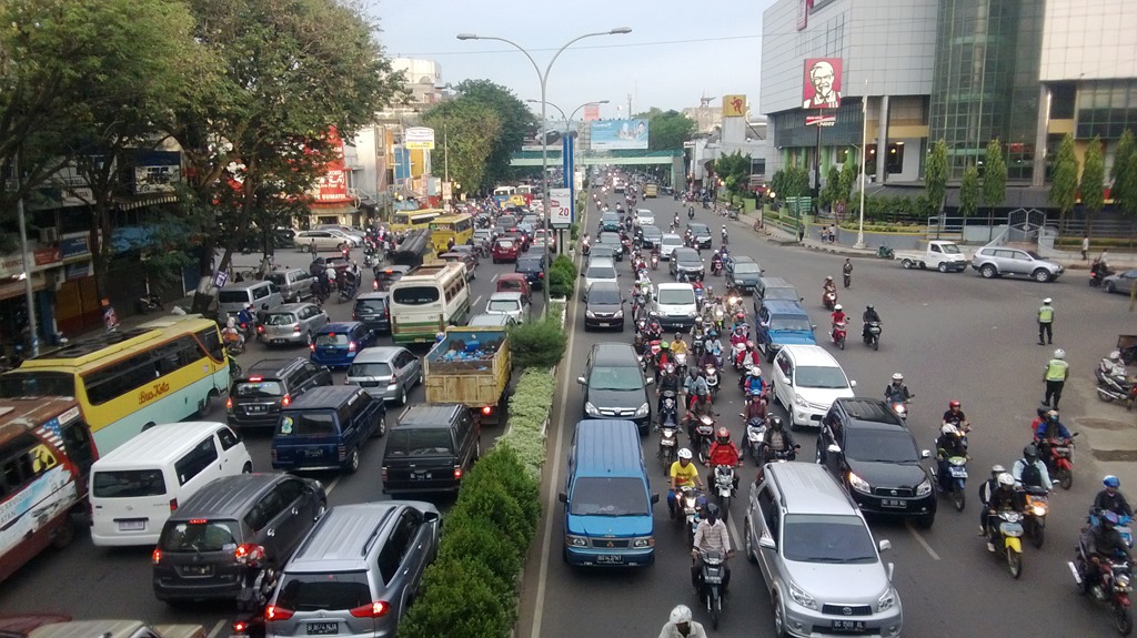
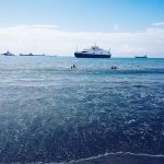
Banten is located near the Sunda Strait’s strategic sea lanes that link Australia and New Zealand with Southeast Asia, for example Thailand, Malaysia, and Singapore. In addition, Banten is the link between Java and Sumatra. Economically, the Banten region area has many industries. Banten also has some seaport that is developed in anticipation to capture the excess capacity of the seaport in Jakarta, and is also intended to be an alternative to the Port of Singapore.
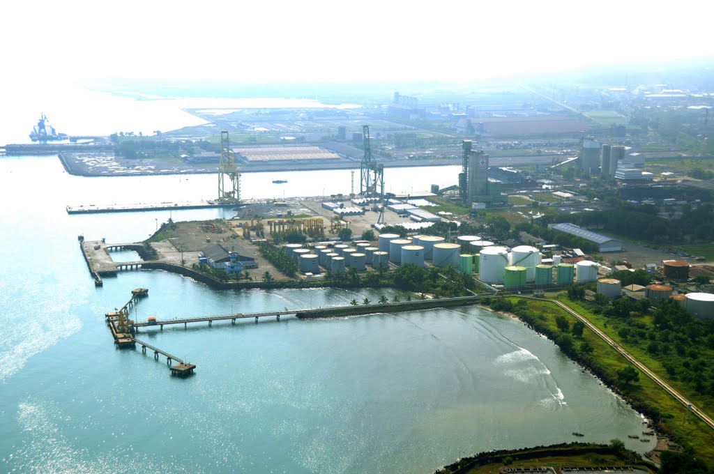 Located on the western tip of Java makes Banten as the gateway to Java and Sumatra and the adjacent areas of Jakarta which is the capital of Indonesia. The geostrategic position caused Banten to become the center of trade lanes between Sumatra and Java even as part of a circulation of Asian and international trade as well as the location of agglomeration economies and potential settlements. As the province borders the Java Sea to the north, the Sunda Strait to the west, and the Indian Ocean to the south, the province has an abundant marine resources.
 Topography
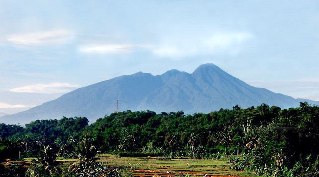
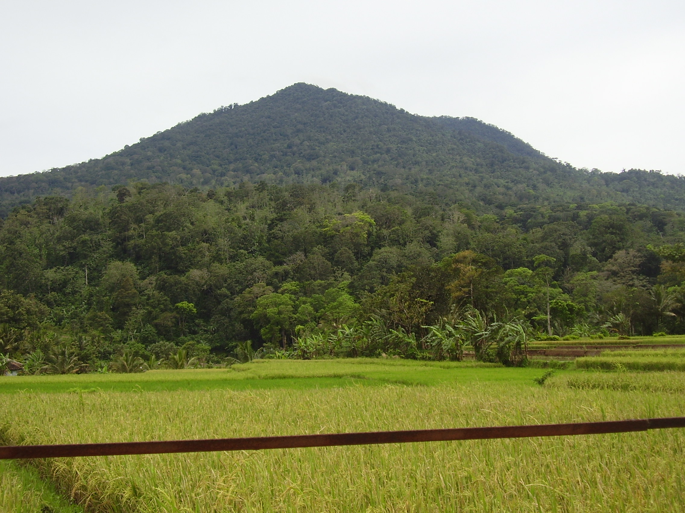
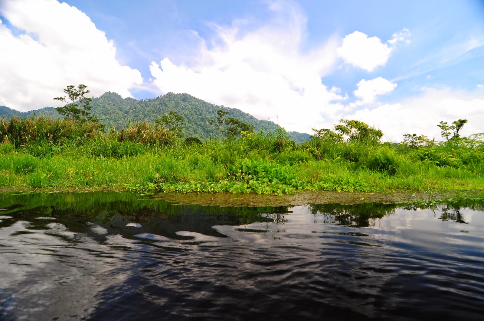
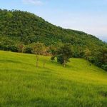
The topography of Banten province at an altitude ranging from 0–1000 m asl. In general the topography of Banten is mostly low land which ranges between 0–200 m above sea level, located in Cilegon, Tangerang, Pandeglang Regency, and most of the Serang Regency. The Central region of the Lebak Regency and Pandeglang Regency has a height ranging from 201 m to 2000 m and the Eastern region of the Lebak Regency has an altitude 501–2000 m located at the summit of Mount Sanggabuana and Mount Halimun.
 The topography of the province associated with the surface expression shape or morphology of a region. The morphology of Banten is generally divided into three groups: the lowlands, sloping hills and steep hills. The lowlands are generally found in the northern and southern portion of the province. The lowlands generally has a height of less than 50 meters.
The sloping hills region have a minimum height of 50 m above sea level. In the north of the city of Cilegon there is a hill called Mount Gede that has an altitude of 553 m above sea level, while there are hills in Serang Regency, precisely in southern region of the regency at the Mancak District and the Waringin Kurung District. The area at the southern part of the Pandeglang Regency are also mostly hilly. In eastern part of the Lebak Regency that is bordering Bogor Regency and Sukabumi Regency in West Java, most of the area is made up of very steep hills which has the characteristics of lithology lithologic unit occupied by the old sediments intruded by igneous rocks such as granite, granodiorite, diorite and andesite. Usually the area contains tin and copper ore deposits that are economically valuable.
 Climate
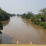
The climate in the Banten is strongly influenced by monsoon wind and the La Niña or the El Niño wave . During the rainy season, the weather is dominated by the west wind (of Sumatra, the Indian Ocean south of the Indian Subcontinent) and are joined by winds from Northern Asia passing through the South China Sea.
 During the dry seasons, the weather is dominated by the east wind which causes Banten harsh drought, especially in the northern part of the coast, especially when there is the El Niño phenomenon. Temperatures in coastal areas and hills ranging between 22 °C and 32 °C, while the temperature in the mountains with an altitude of between 400 –1350 m above sea level ranging between 18 °C and 29 °C.
 The highest rainfall is around 2712–3670 mm which happens in the rainy season months of September to May cover 50% area of the western part of the Pandeglang Regency and rainfall 335–453 mm in the month from September to May cover 50% area of the northern part of the Serang Regency, the entire area of the city of Cilegon, 50% area of the Tangerang Regency and the entire area of the city of Tangerang.
In the dry season, the highest rainfall of 615–833 mm in April–December cover 50% area of the northern part of the Serang Regency, the whole area of the city of Cilegon, 50% area of the northern part of the Tangerang Regency and the entire area of the city of Tangerang, while the bulk the lowest rainfall in the dry season as much as 360–486 mm in the month of June to September 50% coverage area of southern Tangerang Regency and 15% area of southeastern Serang Regency.
 Demographics
In 2006, the population of Banten numbered 9,351,470 people, with a ratio of 3,370,182 people (36.04%) children, 240,742 people (2.57%) elderly people, the remaining 5,740,546 people aged between 15 and 64 year. This makes Banten the fifth-most populated province in Indonesia, after West Java, East Java, Central Java and North Sumatra.
 Ethnic groups
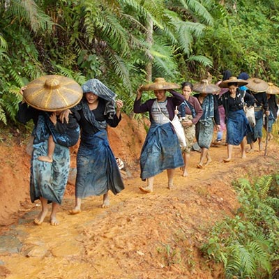
The Bantenese people are the largest group in the province, forming 47% of the total population. The Bantenese are a subgroup of the Sundanese people, with distinct culture from the Sundanese living in West Java. They mostly inhabit the central and southern part of the province. The origins of the Bantenese people; which are closely related to the Banten Sultanate, are different from the Cirebonese people whom are not part of the Sundanese people nor the Javanese people (unless it is from the result of a mixture of two major cultures, namely Sundanese and Javanese).
 The Bantenese people along with the Baduy people (Kanekes) are essentially sub-ethnics of the Sundanese people that occupies the former region of the Banten Sultanate (region of Bantam Residency after the abolishment and annexation by the Dutch East Indies). After the formation of the Banten Province only did people began to regard the Bantenese as a group of people with a culture and language of their own.
Most of the people in northern Banten are Javanese. Most of the Javanese are migrants from the central and eastern part of Java. The Betawi people lives in the Greater Jakarta area, such as Tangerang. Chinese Indonesians can also be found in urban areas, also mostly in the Greater Jakarta area. A sub-group of the Chinese Indonesian called the Benteng Chinese lives in Tangerang and the surrounding area. They are somewhat distinct from the normal Chinese-Indonesian.


![]() Languages
Languages
The most dominant language is Sundanese. The indigenous people living in Banten Province speak a Sundanese dialect derived from archaic Sundanese language. The dialect is classified as informal or harsh layer in modern Sundanese language, having different layers as Javanese language.
 Due to the influence of the Javanese culture during the reign of the Islamic Mataram kingdom, the Sundanese language – especially in the Parahyangan area – have different layers starting from the most formal, or “halus/lemes” version, to the everyday “loma/lancaran” version and the informal or harsh version.
Mataram Sultanate tried to take control over Java island, including Banten territory covering the whole West Java region. But the Sultanate of Banten could defend its territory except Parahyangan area. In the mountainous regions and most of present-day Banten, the loma version of Sundanese language is the most dominant.
 By contrast, this version is considered “harsh” by people from Parahyangan. Bantenese language is commonly used especially in the southern region of Banten such as Pandeglang Regency and Lebak Regency. However, around Serang and Cilegon, Banten Province, a dialect of the Javanese language, the Banyumasan is also spoken by about 500,000 people.
 And, in Northern part of Tangerang City, Serpong, Indonesian language with Betawi dialect is also used by Betawi immigrants. Besides Sundanese, Javanese and Betawi dialect, Indonesian language is also widely spoken especially by other ethnic immigrants from other parts of Indonesia especially in urban centers. The Baduy people speak the Baduy language, also an archaic form of the Sundanese.
 Religion
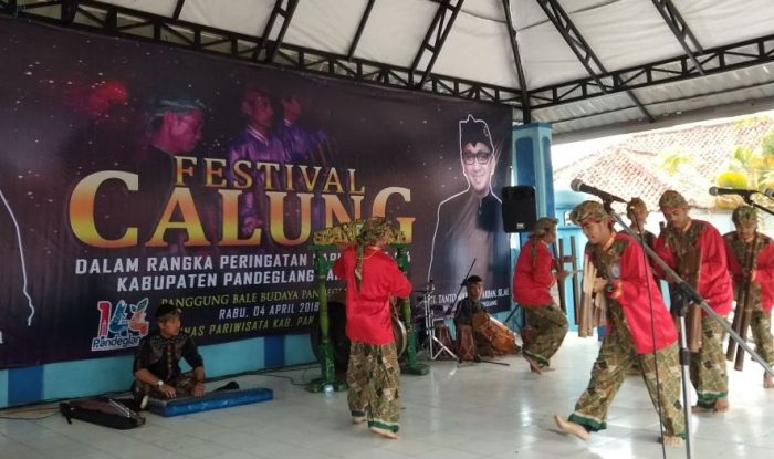
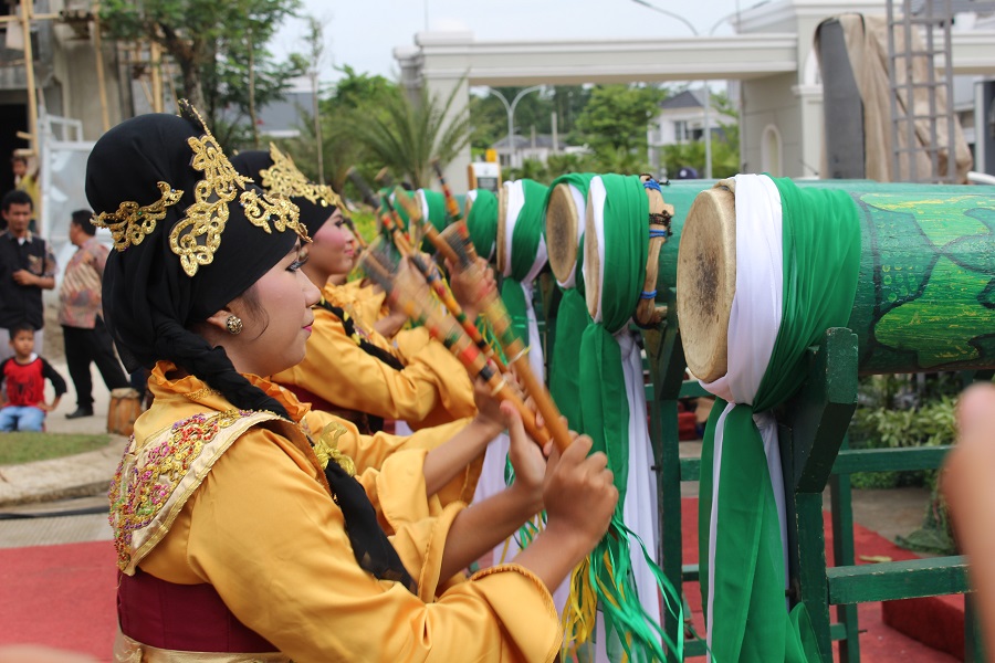
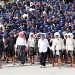
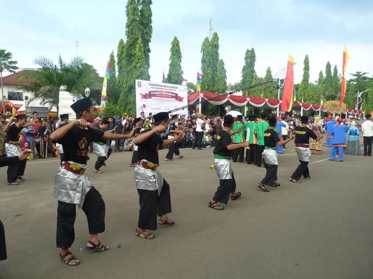
The majority of the people living are generally practicing Muslims, which is due to being inseparable from a strong Islamic cultural background. This case is also closely related to the history of Banten Sultanate as one of the largest Islamic kingdom in the island of Java. Besides that, the artistry in Banten region also portrays Islamic activities of its society, such as the Rampak Bedug performance from Pandeglang Regency.
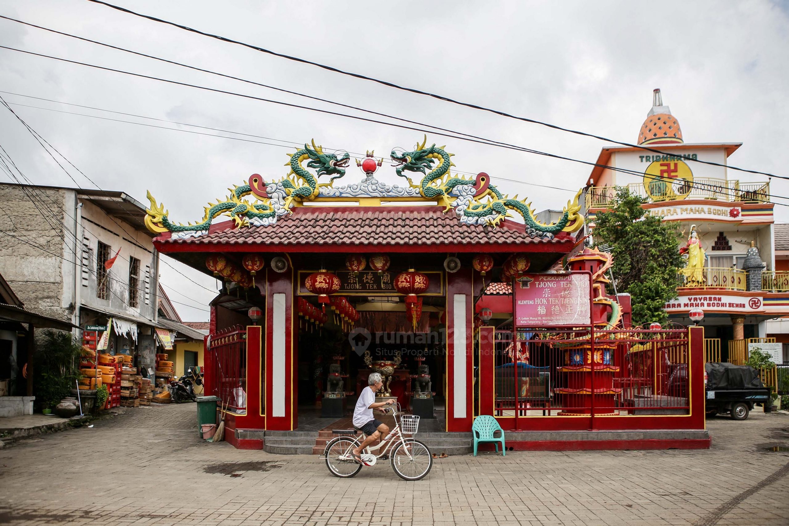 Even so, Banten Province is a multi-ethnic society consisting of various ethnics and religions. Adherents of other faiths from various non-indigenous ethnic groups live alongside each other peacefully in this region, such as the Benteng Chinese community in Tangerang and the Baduy people that practices Sunda Wiwitan in Kanekes, Leuwidamar, Lebak Regency.
 Based on archaeological data, the early period of Banten society was influenced by several kingdoms that brought Hindu-Buddhist beliefs, such as Tarumanagara, Sriwijaya and the Sunda Kingdom. According to the Babad Banten, Sunan Gunung Jati and Maulana Hasanuddin carried out the spread of Islam intensively to the authorities of Banten Girang and their inhabitants.
 Some mystical stories also accompanied the process of Islamization in Banten, including when Maulana Yusuf began to spread da’wah to the inhabitants of the interior, which was marked by the conquest of Pakuan Pajajaran.
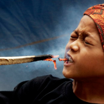
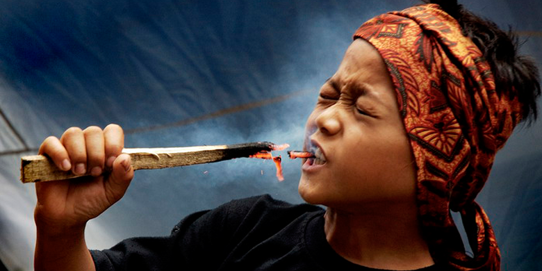
Islam became the pillar of the founding of the Banten Sultanate, the Sultan of Banten was referred to as having genealogies to the Prophet Muhammad, and placing the ulamas had a profound influence on the lives of his people, along with the tarekat and tasawuf also developed in Banten. While the culture of society absorbs Islam as an inseparable part. Some existing traditions are influenced by the development of Islam in society, as seen in Debus martial arts.
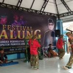
 Culture
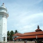
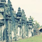
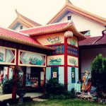
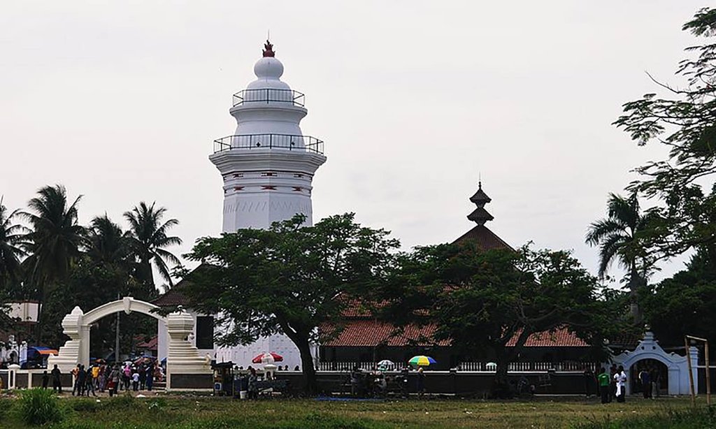
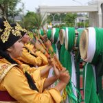
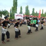
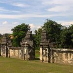
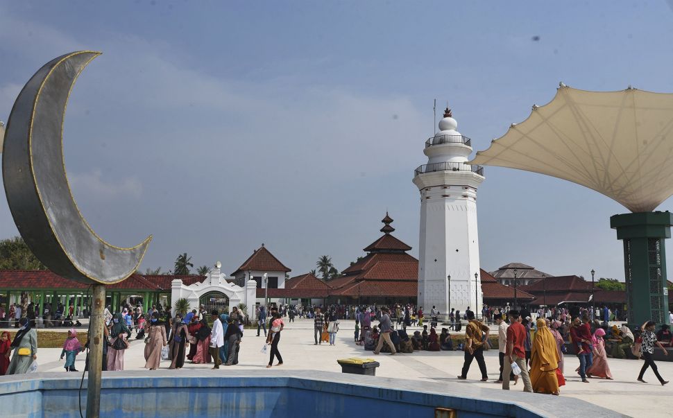
The culture is hugely based on Hinduism and Buddhism and recently Islamization. The cultural potential and peculiarities of the people of Banten include the Pencak Silat martial arts, Debus, Rudad, Umbruk, Saman Dance, Mask Dance, Cokek Dance, Dog-dog, Palingtung, and Lojor. In addition, there are also many religious locations such as the Great Mosque of Banten, the Keramat Panjang Tomb, and many other places.
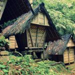
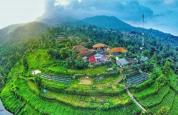
 In the central and southern part of the province lives the Baduy people. The Baduy can be separated into the Outer Baduy tribes and the Inner Baduy tribes. The Inner Baduy tribes are native Sundanese who still maintain the tradition of anti-modernization, both dress and other life patterns, while the Outer Baduy tribes are more open to modernization.
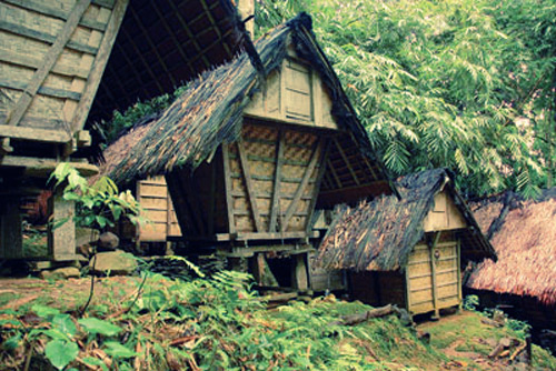
The Baduy-Rawayan tribe lives in the Kendeng Mountains Cultural Heritage area of 5,101.85 hectares in the Kanekes area, Leuwidamar District, Lebak Regency. Baduy villages are generally located in the Ciujung River in the Kendeng Mountains. This area is known as the area of inheritance from ancestors, which must be maintained and maintained properly, should not be damaged.


 Traditional weapon
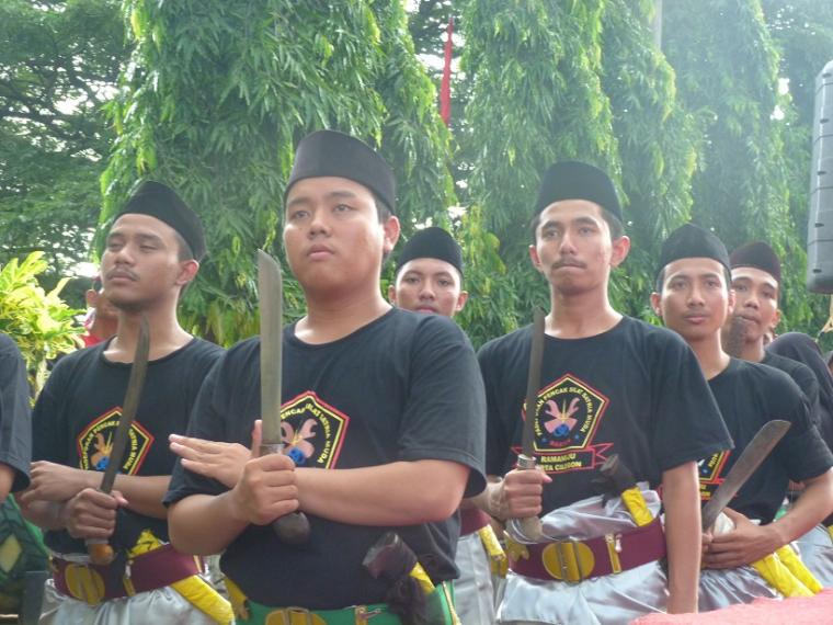
Golok is the traditional weapon of Banten. This type of weapon is very close to the warrior and champion of Banten. Formerly, Golok functioned as a self-defense weapon, but now only as a martial arts tool. One of famous known type of Golok is the Ciomas Golok, which is only made in Ciomas at the Serang Regency.
 Ciomas Golok is famous for their sharpness and mystical value. According to the story of Ciomas Golok is only made during the Islamic month of Maulud and through a long ritual stage.
Golok is also inseparable from the culture of both the Bantenese people and the Baduy people. The Baduy people always carries Golok wherever they go. Golok becomes the main tool when they are farming and hunting in the forest. In addition, Banten also has other types of traditional weapons, such as kujang, kris, spears, sledgehammer, machetes, swords and arrows.
 Traditional house
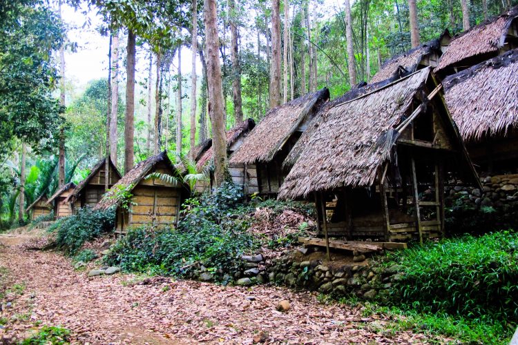
The traditional house in Banten called Rumah Panggung with roof thatching, and the floor is made of pounded bamboos split. While the walls were made from the booth (gedek). To buffer stage house is a stone that has been created in such a way that ends shaped beam decreasing as the stone used for pounding rice pedestal. The traditional house is still widely found in areas inhabited by the Kanekes people or the Baduy.
 Traditional clothes
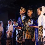
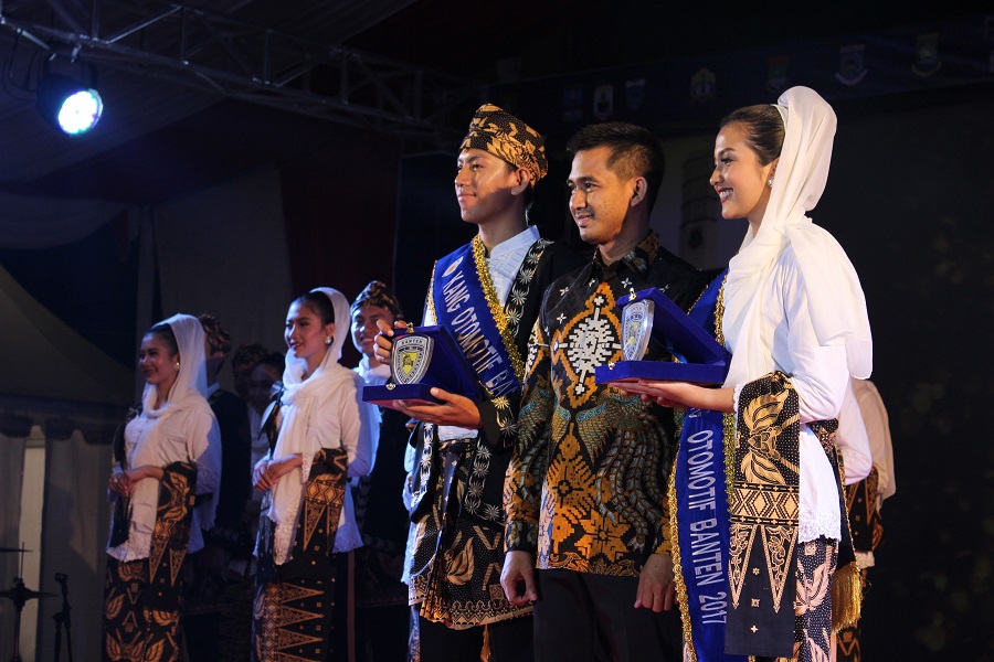
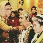
Traditional Bantense men tend to wear with koko shirts and closed neck. And the bottom clothes are equipped with trousers and tied with batik cloth. Usually, the men would wear a belt and tucked a Golok in the front of the belt. As well as on the shoulder, a piece of cloth is attached.
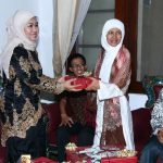
While Bantenese women usually wears traditional kebaya clothes and inner fabrics as subordinates. This garment is also slung over a cloth on the shoulder and decorated with a hand-crafted brooch on the front of the button. The hair is in a bun and is decorated with a golden sway flower.
Tangerang Selatan
Tangerang
Serang Selatan
Cilegon
Tangerang
Serang
Lebak
Pandeglang
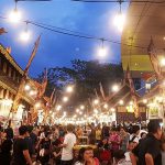
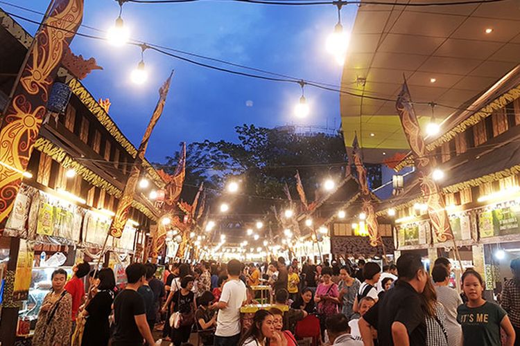
 Tourism
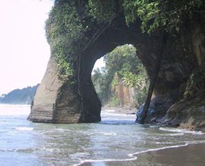
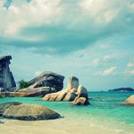
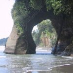
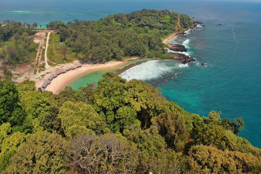
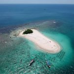
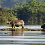
Ujung Kulon National Park is one of the national parks and nature conservation sites that are important in Indonesia, and the world. This national park is located in the most western peninsula of the island of Java, plus some smaller islands as well as Peucang, Handeuleum Island, and the island of Panaitan. The highest point is Mount Honje.
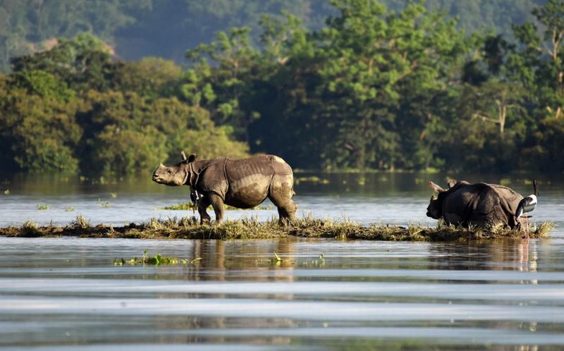 The distinctive feature of this national park is its role as a natural habitat of wildlife species that are protected, such as the Javan rhino, deer, antelope, buffalo, various species of primates, wild boar, jungle cat, sloth, and various species of birds. This area can be reached via Labuan or via the sea by boat to one of the islands there.
Ujung Kulon has been equipped with various means of telecommunications networks, electricity, and clean water. Tourism facilities such as accommodation, information centers, travel guides, and transportation facilities have also been provided. UNESCO has stated that the Ujung Kulon area is a nature reserve world heritage sites.
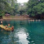
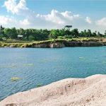
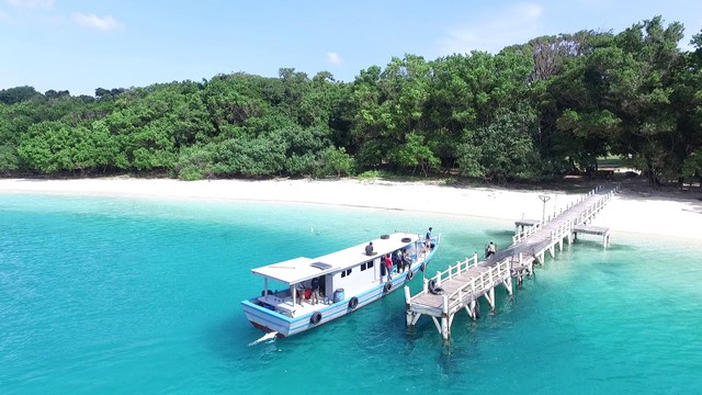
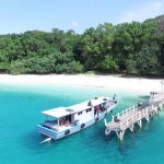
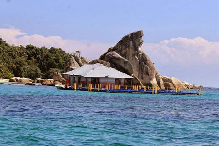 Pulau Dua which is located near Serang is well known the natural beauty of the ocean in the form of clusters of coral, various types of fish, and of course various types of birds. The area is about 30 ha. Each year between April and August, the island is visited by thousands of birds from 60 species originating from various countries.
Approximately forty thousand of these birds fly from the continent of Australia, Asia, and Africa. Two of the islands can be reached by traditional boats or motor boats; or on foot within 15 to 30 minutes through aquaculture area in Sawah Luhur and Kasemen. Due to sedimentation for decades, the island has been united with the mainland Java.
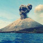
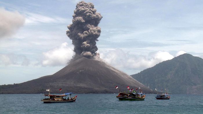 Mount Krakatau actually included the province of Lampung is located in the Sunda Strait. This mountain is one of the most famous mountains in the world, because of the devastating eruption in 1883. The sound of the eruption was heard up to the Australian Continent region, even heat clouds blanketed some areas of Europe during the week. A huge explosion of Krakatoa then formed Anak Krakatau which surfaced in 1928 and still remains active.
 Although located in the Strait of Sunda and Lampung, nature tourism is more easily accessed in Anyer-Carita Beach, and permission to land on the island volcano Anak Krakatau also be obtained in this area, it takes about an hour by speedboat to reach. Locations: this tour offers natural attractions such as camping, hiking, fishing, and natural scenery of the sea.
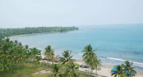
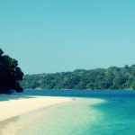
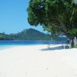
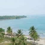
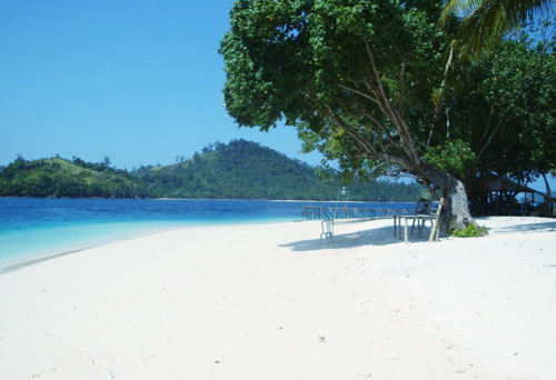
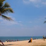
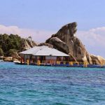
Tanjung Lesung Beach is located in the Panimbang district of Pandeglang Regency in the Banten province. The beach is located in the western part of the Pandeglang Regency and has an area of approximately 150 hectares. This area is proposed to Special Economic Zone since 2012 and Tanjung Lesung SEZ been officially in operation since 23 February 2015. Development of the Tanjung Lesung SEZ are mainly focused on the activities of Tourism and Creative Economy.
 Cuisine
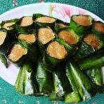
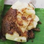
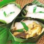
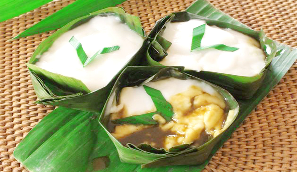
Jojorong, a food originated from Pandeglang. This food is made from rice flour, brown sugar, coconut milk, and pandan leaves which served into a bowl made from banana leaves.
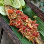
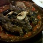
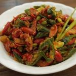
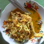
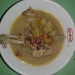
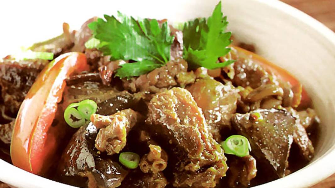
 One of Banten’s typical foods is Rabeg. Rabeg is a typical Bantenese food that is similar to goat or rawon curry. This food is made from goat meat and offal. The food of the nobility and sultan is only found in Serang Regency. The food is believed to be originated from the Arabian Peninsula, spread by Arab traders during the spread of Islam in Indonesia.
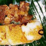
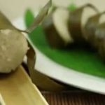
There are also other typical Bantenese foods, such as Nasi sumsum from Serang Regency which is made of white rice and the bone marrow of a buffalo.
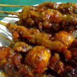
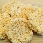
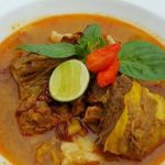
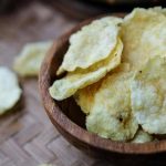
Other typical foods that can be found in Banten are mahbub, broiler, shark fin soup, milkfish satay, duck soup, duck satay, lemong malimping eggplant sapo, laksa tangerang, sticky rice stick, sticky rice cuer, beef jerky and emping.