
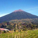
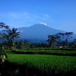
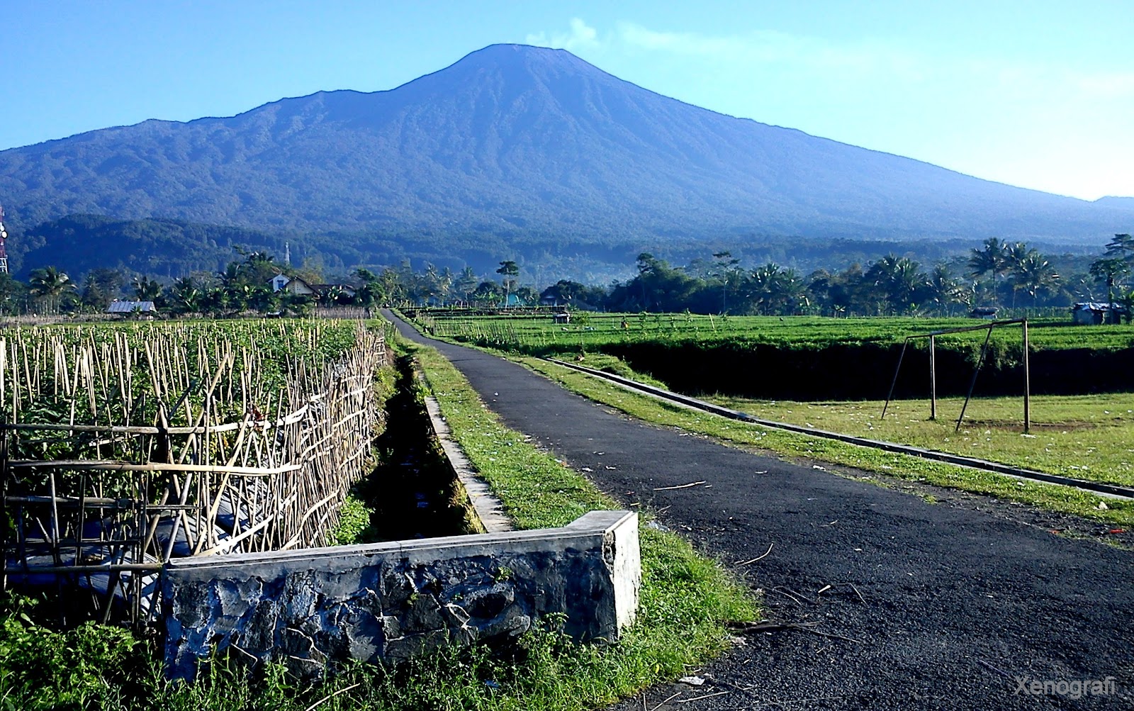
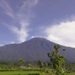
 Geology
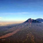
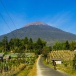
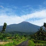
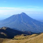
Like other volcanoes on Java Island, Mount Slamet was formed due to the subduction of the Indo-Australian Plate on the Eurasian Plate in the south of Java Island. Cracks in the plates open the pathway for lava to the surface. Records of eruptions are known as far back as the 19th century.
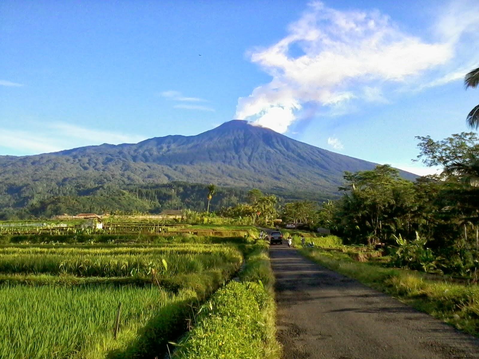
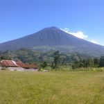
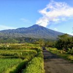
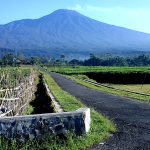
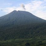
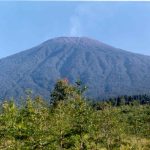
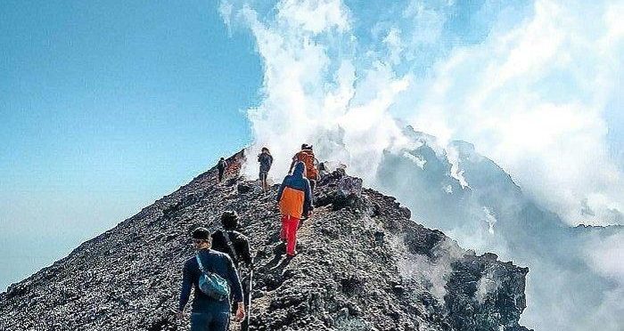
This volcano is active and often experiences small scale eruptions. The last activity was in May 2009 and until June it was still emitting incandescent lava. Previously it was recorded as erupting in 1999.
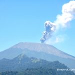
March 2014 Mount Slamet shows activity and status becomes Alert. Based on PVMBG data, Mount Slamet’s volcanic activity is still fluctuating. After an earthquake occurred up to 171 times on Friday 14 March 2014 from 00.00-12.00 WIB, at the same duration of time, there were 57 earthquake eruptions. Also recorded 51 puffs. Visual monitoring, puffs of thick white smoke are still coming out of the crater of the mountain to the east as high as 1 km.
Geology
Like other volcanoes on Java Island, Mount Slamet was formed due to the subduction of the Indo-Australian Plate on the Eurasian Plate in the south of Java Island. Cracks in the plates open the pathway for lava to the surface. Records of eruptions are known as far back as the 19th century.
This volcano is active and often experiences small scale eruptions. The last activity was in May 2009 and until June it was still emitting incandescent lava. Previously it was recorded as erupting in 1999.
March 2014 Mount Slamet shows activity and status becomes Alert. Based on PVMBG data, Mount Slamet’s volcanic activity is still fluctuating. After an earthquake occurred up to 171 times on Friday 14 March 2014 from 00.00-12.00 WIB, at the same duration of time, there were 57 earthquake eruptions. Also recorded 51 puffs. Visual monitoring, puffs of thick white smoke are still coming out of the crater of the mountain to the east as high as 1 km.

 History
In August 1838. Junghuhn, Fritze, Holle and Borst started the journey from Moga to climb Slamet from the north slope. At an altitude of about 4000 feet build huts to spend the night and leave the horses to continue the hike on foot. Dr. Holle found parts of a rhinoceros skeleton in a sandy area next to the crater, and human bones were also found. The very cold night air minimum temperature didn’t drop below 42″ Fahrenheit, but due to strong east winds. Returned the next morning however found frost on plants 3000 to 4000 feet below the summit.
Armed with accurate geodetic and meteorological equipment (as in 1838), Junghuhn, together with some Javanese, climbed the mountain for the second time, on June 19, 1847. Starting at 7 o’clock from Priatin, on the east-north side of G. Slamat, and crossing the plateau most of which are cultivated at elevations of about 4000 feet. As described in his book Java, seine Gestalt, Pflanzendecke und Innere Bauart.
Dutch historian, J. Noorduyn theorizes that the name “Slamet” is relatively recent, namely after the arrival of Islam to Java (the word is a loan from Arabic). He expressed the opinion that what is referred to as Mount Agung in the Sundanese language text about the adventures of Bujangga Manik is Mount Slamet, based on the description of the location mentioned.
History
In August 1838. Junghuhn, Fritze, Holle and Borst started the journey from Moga to climb Slamet from the north slope. At an altitude of about 4000 feet build huts to spend the night and leave the horses to continue the hike on foot. Dr. Holle found parts of a rhinoceros skeleton in a sandy area next to the crater, and human bones were also found. The very cold night air minimum temperature didn’t drop below 42″ Fahrenheit, but due to strong east winds. Returned the next morning however found frost on plants 3000 to 4000 feet below the summit.
Armed with accurate geodetic and meteorological equipment (as in 1838), Junghuhn, together with some Javanese, climbed the mountain for the second time, on June 19, 1847. Starting at 7 o’clock from Priatin, on the east-north side of G. Slamat, and crossing the plateau most of which are cultivated at elevations of about 4000 feet. As described in his book Java, seine Gestalt, Pflanzendecke und Innere Bauart.
Dutch historian, J. Noorduyn theorizes that the name “Slamet” is relatively recent, namely after the arrival of Islam to Java (the word is a loan from Arabic). He expressed the opinion that what is referred to as Mount Agung in the Sundanese language text about the adventures of Bujangga Manik is Mount Slamet, based on the description of the location mentioned.
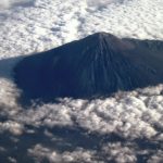
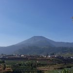
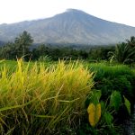
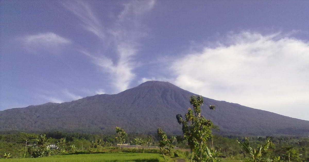 Ecology
This mountain has Dipterocarp Hill forest area, Upper Dipterocarp forest, Montana forest, and Ericaceous Forest or mountain forest.
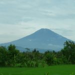
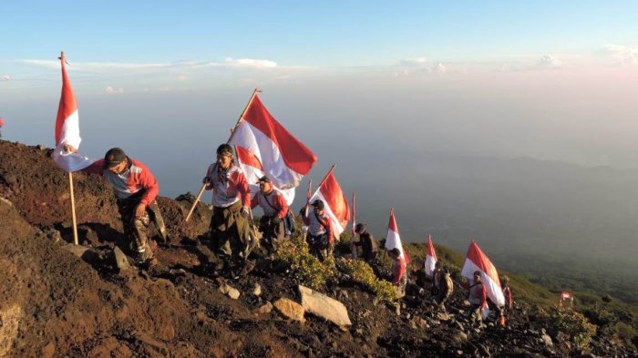
Legend of Mount Slamet
Mount Slamet has a legend that has been passed down from generation to generation. The name Slamet is taken from the Javanese language which means safe. This name was given because it is believed that this mountain has never erupted big and gives a sense of security to local residents.
According to local residents’ beliefs, if Mount Slamet erupts, Java Island will split into two parts. Even so, Mount Slamet has been active several times and has produced interesting phenomena.
Ecology
This mountain has Dipterocarp Hill forest area, Upper Dipterocarp forest, Montana forest, and Ericaceous Forest or mountain forest.
Legend of Mount Slamet
Mount Slamet has a legend that has been passed down from generation to generation. The name Slamet is taken from the Javanese language which means safe. This name was given because it is believed that this mountain has never erupted big and gives a sense of security to local residents.
According to local residents’ beliefs, if Mount Slamet erupts, Java Island will split into two parts. Even so, Mount Slamet has been active several times and has produced interesting phenomena.

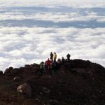
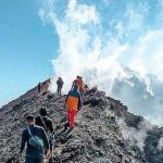

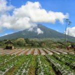


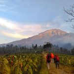
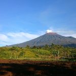
 Hiking trails
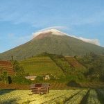
The traditional climbing route of Mount Slamet is from Bambangan, Kutabawa Village, Karangreja District, Purbalingga. Another popular route that has recently been opened from the south (Kab. Banyumas) and north and northeast (Kab.) is from Baturraden and from Gambuhan Village, Jurangmangu Village and Gunungsari Village in Pemalang Regency. In addition, there is also a new route was inaugurated in 2013, namely the Dhipajaya route which is located in Clekatakan Village.
Hiking trails
The traditional climbing route of Mount Slamet is from Bambangan, Kutabawa Village, Karangreja District, Purbalingga. Another popular route that has recently been opened from the south (Kab. Banyumas) and north and northeast (Kab.) is from Baturraden and from Gambuhan Village, Jurangmangu Village and Gunungsari Village in Pemalang Regency. In addition, there is also a new route was inaugurated in 2013, namely the Dhipajaya route which is located in Clekatakan Village.
 Climbing Mount Slamet is known to be quite difficult because almost along the climbing route there is no water found. Hikers are advised to bring an adequate supply of water from below. Another complicating factor is the fog. The fog on Mount Slamet is very changeable and thick.
Another hiking trail is through the Guci hot spring tourist attraction, Tegal Regency. Although steep, this route presents the best views. The Guci area can be reached from Slawi to the Tuwel area via Lebaksiu, while the currently popular hiking trail is the Permadi Guci route where there is a Jabalussalam prayer room which is included in the list of the third highest prayer room in Indonesia, abundant clean water available throughout the year and toilets available. public who are at post 4 Amreta hiking trails.
Climbing Mount Slamet is known to be quite difficult because almost along the climbing route there is no water found. Hikers are advised to bring an adequate supply of water from below. Another complicating factor is the fog. The fog on Mount Slamet is very changeable and thick.
Another hiking trail is through the Guci hot spring tourist attraction, Tegal Regency. Although steep, this route presents the best views. The Guci area can be reached from Slawi to the Tuwel area via Lebaksiu, while the currently popular hiking trail is the Permadi Guci route where there is a Jabalussalam prayer room which is included in the list of the third highest prayer room in Indonesia, abundant clean water available throughout the year and toilets available. public who are at post 4 Amreta hiking trails.