 Geology
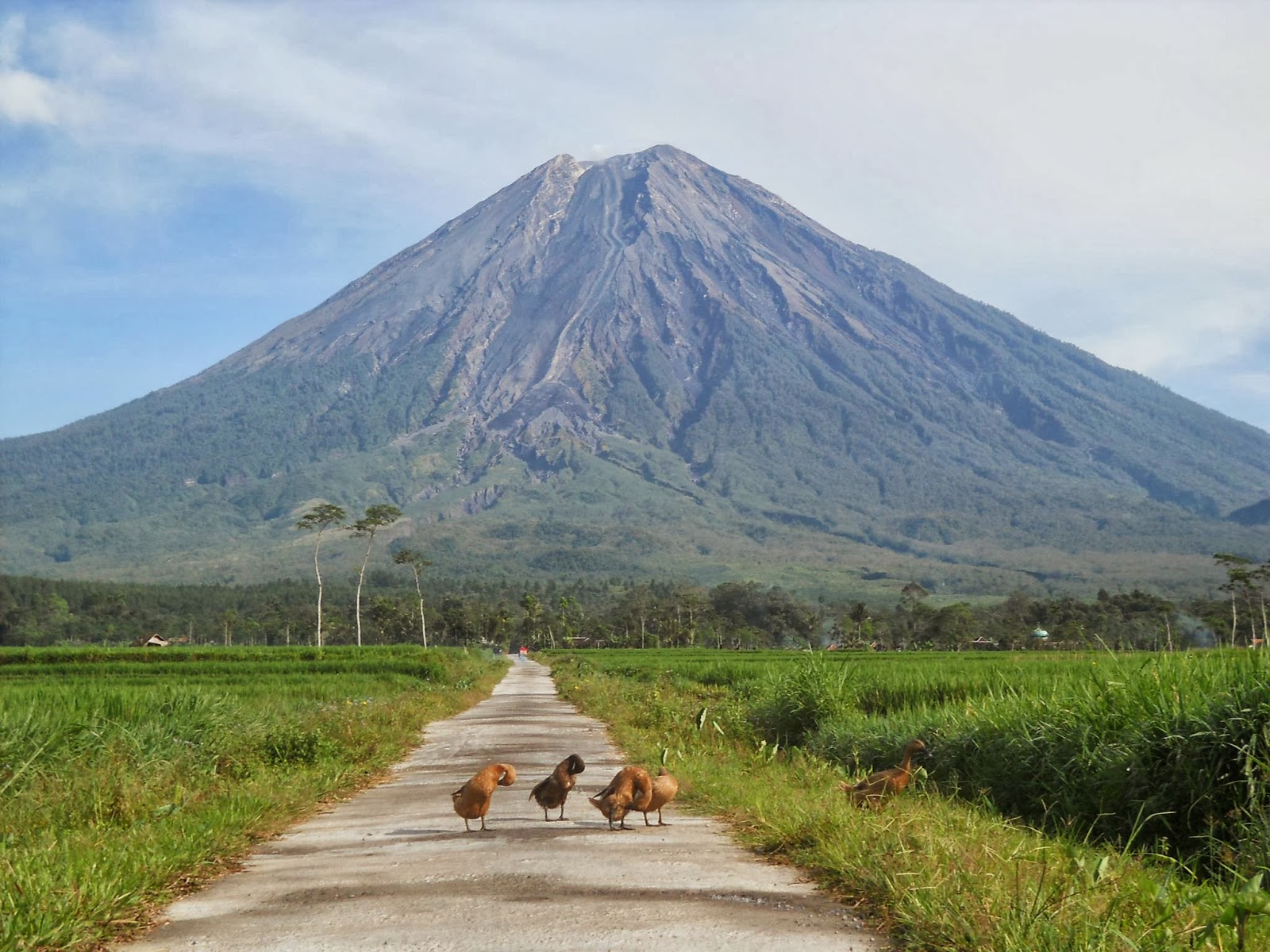
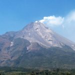
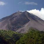
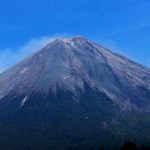
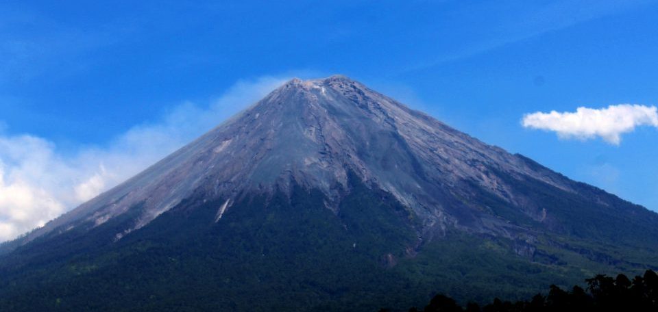
Semeru rises steeply above the coastal plains of eastern Java. Maars containing crater lakes have formed along a line through the summit of the volcano. It was formed south of the overlapping Ajek-ajek and Jambagan calderas. The eruptive products are andesitic. Semeru lies at the south end of the Tengger Volcanic Complex.
Climate
In general, the climate in the Mount Semeru area belongs to climate type B (Schmidt and Ferguson) with 927 mm – 5,498 mm of rain per year with 136 rainy days / year and the rainy season falls in November – April. The air temperature at the peak of Semeru ranges from 0-4 degrees Celsius.
The average temperature ranges from 3 °C – 8 °C at night and early morning, while during the day it ranges from 15 °C – 21 °C. Sometimes in some areas there is a small snowfall when the rainy season changes to the dry season or vice versa. The cold temperatures along this route are not solely caused by the still air, but also supported by the strong winds that blow into this area causing the air to get colder.
 National Park
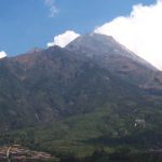
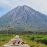
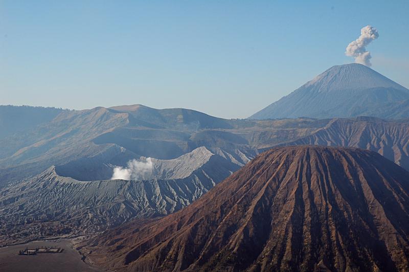
This mountain is included in the Bromo Tengger Semeru National Park area. This National Park consists of mountains and valleys covering an area of 50,273.3 hectares. There are several mountains within the Mount Tengger Caldera, including: Mount Bromo (2,392 m); Mount Batok (2,470 m); Seat Mountain (2,581 m); Mount Watangan (2,662 m); and Mount Widodaren (2,650m). There are four lakes (ranu): Ranu Pani, Ranu Regulo, Ranu Kumbolo and Ranu Darungan.
There are various types of flora in the Mount Semeru area but are mostly dominated by spruce, acacia, pine, and Jamuju species. Meanwhile, the undergrowth is dominated by kirinyuh, reeds, tembelekan, harendong and white edelwiss. Edelwis is also commonly found on the slopes leading to the summit of Semeru. There is also an endemic species of orchid that lives around the southern part of Mount Semeru, namely the Slipper Orchid.
Many fauna that inhabit Mount Semeru include: panthers, budeng, mongoose, deer, deer, etc. Meanwhile, at Ranu Kumbolo there are grouses that still live wild.
 Legend of Mount Semeru
According to Javanese beliefs written in the ancient book Tantu Pagelaran dating from the 15th century, long ago the island of Java was floating in the vast ocean, bobbing and constantly shaking. The Gods decided to nail the island of Java by moving Mount Meru in India to the island of Java.
Lord Vishnu transformed into a giant turtle carrying the mountain on his back, while Lord Brahma transformed into a long snake that wrapped his body around the mountain and the turtle’s body so that the mountain could be transported safely.
The gods placed the mountain on the first part of the island they encountered, namely in the western part of the island of Java. But the weight of the mountain caused the eastern tip of the island to be lifted up. Then they moved it to the eastern part of the island of Java. When Mount Meru is brought to the east, the scattered fragments of Mount Meru create a mountain range on the island of Java that extends from west to east. However, when the peak of Meru was moved to the east, the island of Java was still tilted, so the gods decided to cut off part of the mountain and place it in the northwest. This fragment formed Mount Pawitra, which is now known as Mount Penanggungan, and the main part of Mount Meru, the abode of Lord Shiva, now known as Mount Semeru. When Sang Hyang Shiva came to the island of Java, he saw many Jawawut trees, so the island was called Java.
 The geographical environment of the islands of Java and Bali is indeed compatible with the symbols of Hinduism. In Hinduism there is a belief about Mount Meru, Mount Meru is considered the home of the gods and as a means of connecting between the earth (humans) and Heaven. Many Javanese and Balinese people still think of the mountain as the abode of Gods, Hyangs, and spirits.
According to the Balinese, Mount Mahameru is believed to be the father of Mount Agung in Bali and is respected by the Balinese people. The offering ceremony to the gods of Mount Mahameru is performed by the Balinese. After all, the ceremony is only carried out once every 8-12 years only when people receive a magical voice from the god of Mount Mahameru. In addition to the offering ceremony, Balinese people often come to the Widodaren Cave area to get holy Tirta.
 Eruptive History
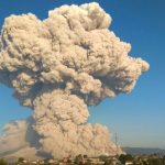
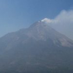
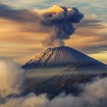
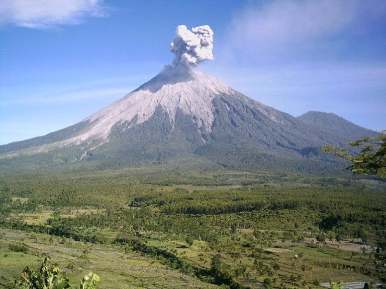
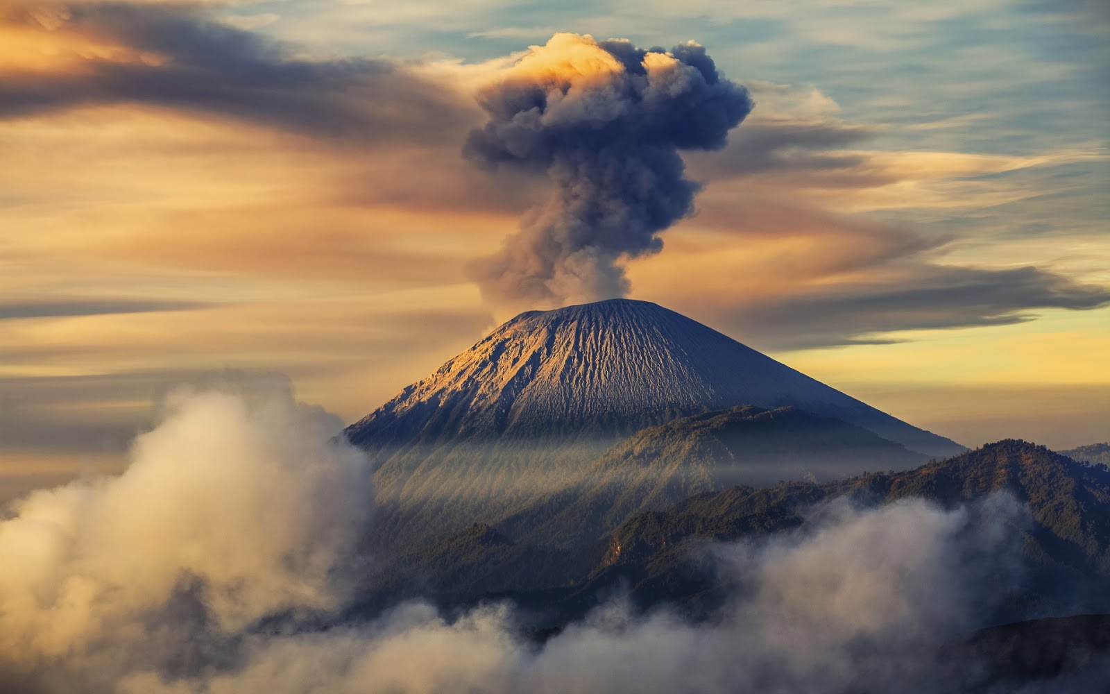
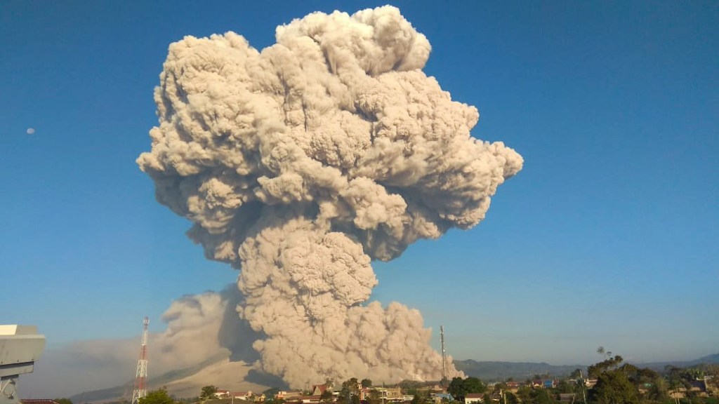
Semeru’s eruptive history is extensive. Since 1818, at least 55 eruptions have been recorded (11 of which resulted in fatalities) consisting of both lava flows and pyroclastic flows. All historical eruptions have had a Volcanic Explosivity Index (VEI) of 2 or 3. Semeru has been in a state of near-constant eruption from 1967 to the present.
Semeru is regularly climbed by tourists, usually starting from the village of Ranu Pane to the north,[citation needed] but though non-technical, it can be dangerous. Soe Hok Gie, an Indonesian political activist of the 1960s, died in 1969 from inhaling poisonous gases while hiking on Mount Semeru.
Semeru is named after Sumeru, the central world-mountain in Hinduism. As stated in legend, it was transplanted from India; the tale is recorded in the 15th-century East Javanese work Tantu Pagelaran. It was originally placed in the western part of the island, but that caused the island to tip, so it was moved eastward. On that journey, parts kept coming off the lower rim, forming the mountains Lawu, Wilis, Kelud, Kawi, Arjuno and Welirang. The damage thus caused to the foot of the mountain caused it to shake, and the top came off and created Penanggungan as well. Indonesian Hindus also hold a belief that the mountain is the abode of Shiva in Java.
 1800’s
The first recorded eruption record is estimated at November 8, 1818. In the 1829-1878 range there were also several eruptions until 1913 but not much documented information. Eruptions in the 19th century AD occurred in 1829, 1830, 1832, 1836, 1838, 1842, 1844, 1845, 1848, 1851, 1856, 1857, 1860, 1864, 1867, 1872, 1877, and 1878. it erupted again in 1884 to 1899.
1900’s
In 1941-1942, long duration volcanic activity was recorded. The Center for Volcanology and Geological Hazard Mitigation (PVMBG) stated that the lava flow occurred in the period from September 21, 1941 to February 1942. At that time, the eruption reached the eastern slope with a height of 1,400 to 1,775 meters. Volcanic material to pile up the Bantengan irrigation post.
Several volcanic activities were also recorded in succession in 1945, 1946, 1947, 1950. They erupted again in succession from 1951 to 1961 and 1963. Successive eruptions occurred again from 1967 to 1969 and 1972 to 1990. The next eruption was followed in in 1992 and 1994. The eruption in 1994 was horrific because it claimed the lives of 7 people and people were swept away by the lava.
 On December 1, 1977, a lava avalanche produced hot clouds of avalanches with a distance of up to 10 km in Besuk Kembar. The observed volume of volcanic material deposits reached 6.4 million cubic meters. Hot clouds also point to the Besuk Kobokan area. At that time, rice fields, bridges and residents’ houses were damaged. Volcanic activity continued and was recorded in 1978–1989.
On February 2, 1994, there were 9 eruptions of Mount Semeru. This eruption resulted in the emergence of thick white smoke with a height of up to 500 meters. In addition to white smoke, there were 34 lava avalanches in the direction of Besuk Twins as far as 1 km. The eruption of Mount Semeru claimed the lives of 7 people who were swept away by the lava.
2000’s
PVMBG also recorded volcanic activity of this mountain in 1990, 1992, 1994, 2002, 2004, 2005, 2007 and 2008. In 2008, several eruptions were recorded, namely in the range of 15-22 May 2008. Observed on 22 May 2008, four avalanches were recorded. hot clouds that lead to the Besuk Kobokan area with a sliding distance of 2,500 meters.
 On 12 June 2006, the Tanjung Perak Maritime Meteorology and Geophysics Agency (BMKG) recorded a volcanic earthquake with a magnitude of 1.8 on the Richter Scale (SR) due to the activity of Mount Semeru (3,676 masl).
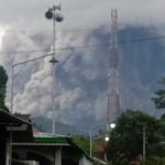
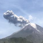
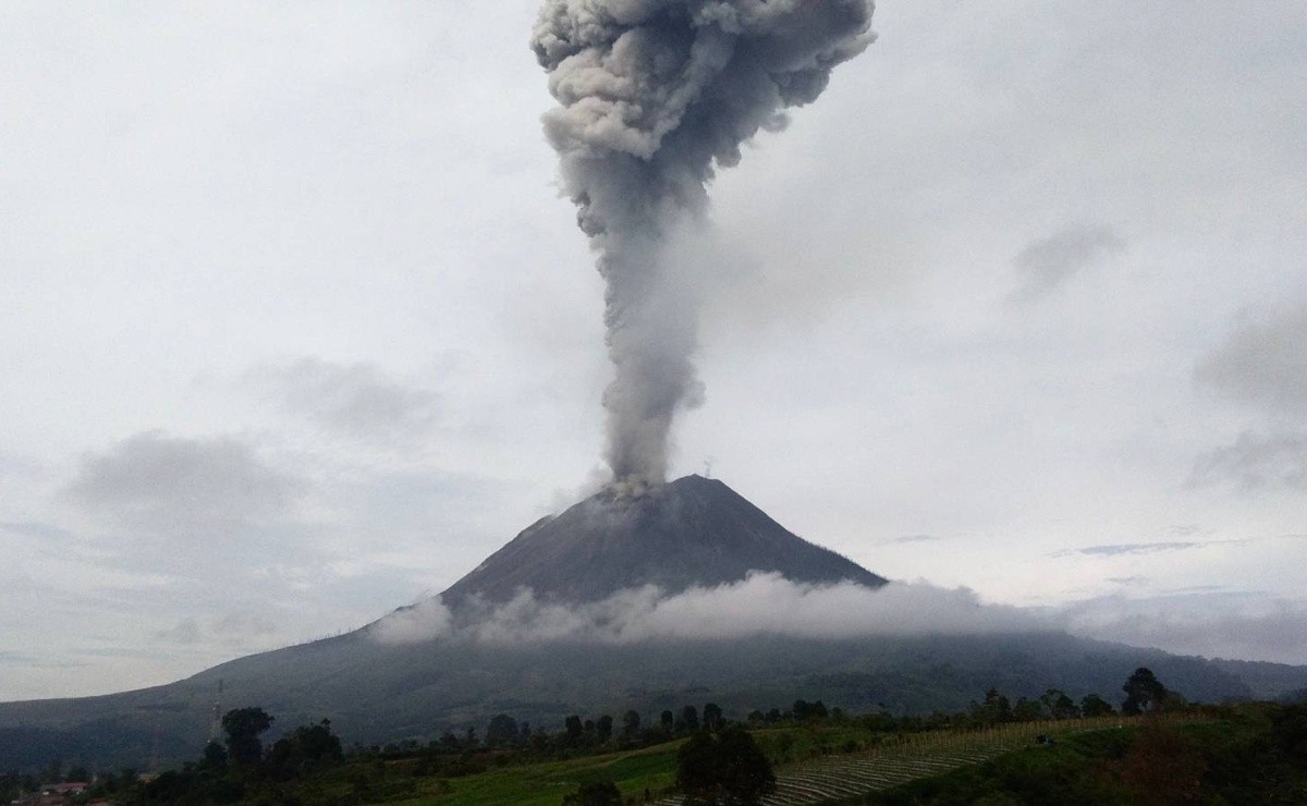
On December 1, 2020, Mount Semeru experienced an eruption which was followed by hot clouds falling from the summit. The sliding distance of this hot cloud is 2-11 kilometers.
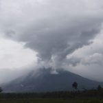
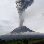
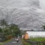
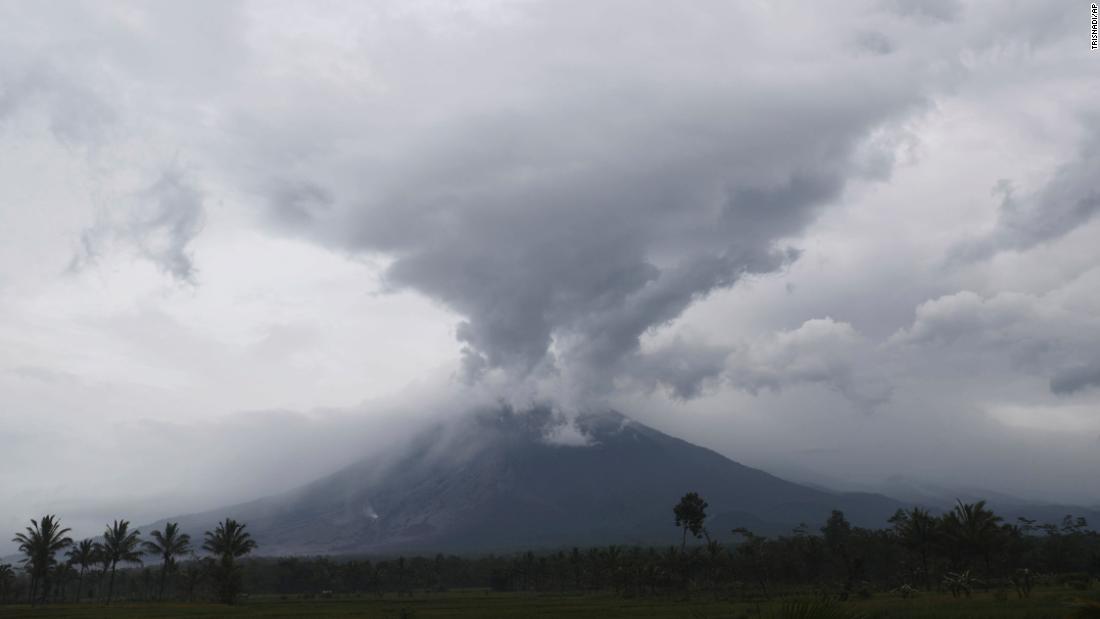
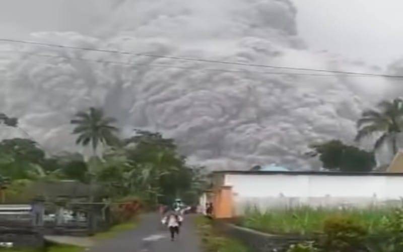 On December 4, 2021 at 15:10 WIB, Mount Semeru erupted and emitted a hot cloud fall towards Besuk Kobokan, Sapitarang Village, Pronojiwo District, making the last and most recent eruption in a number of BNPB. The lava fall traveled with a sliding distance of 500-800 meters, with the center of the fall 500 meters below the crater. Meanwhile, volcanic earthquakes related to eruptions, avalanches and gusts of crater smoke have occurred as many as 54 earthquake eruptions or eruptions, 4 avalanches earthquakes, and 18 earthquake gusts.
On 4 December 2021, Semeru erupted for a second time in the year – the first having been in January 2021. Semeru errupted a third time on 6 December 2021. At least 22 people have been killed in the December eruption, while 27 people are missing. 89 people in total suffered burns caused by the eruption.