
 A study conducted in 2001 determined that Tangkuban Perahu has erupted at least 30 times in the previous 40,750 years. Studies of the tephra layers within three kilometres of the crater revealed that 21 were minor eruptions and the remaining were significant eruptions.
 The eruptions that occurred prior to approximately 10,000 years ago were magmatic – phreatomagmatic, and the ones that occurred after 10,000 years ago were phreatic. The volcano erupted as recently as 26 July 2019. On 2 August 2019, the volcano experienced eight minor eruptions, and as a result, the place was closed down for visitors, but is open again.
Formation and Eruption History
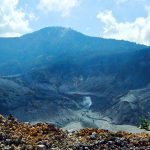
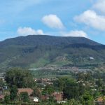
 Mount Tangkuban Parahu was formed around 90,000 years ago in the Sunda Caldera. This mountain, is younger than Mount Burangrang. Mount Burangrang, which is located on the west side of Mount Tangkuban Parahu, was formed around 210,000 to 105,000 years ago. Mount Tangkuban Parahu was born after the formation of the Lembang Fault. When Mount Tangkuban Parahu erupted, some of the material that flowed to the south was stuck at the foot of the fault.
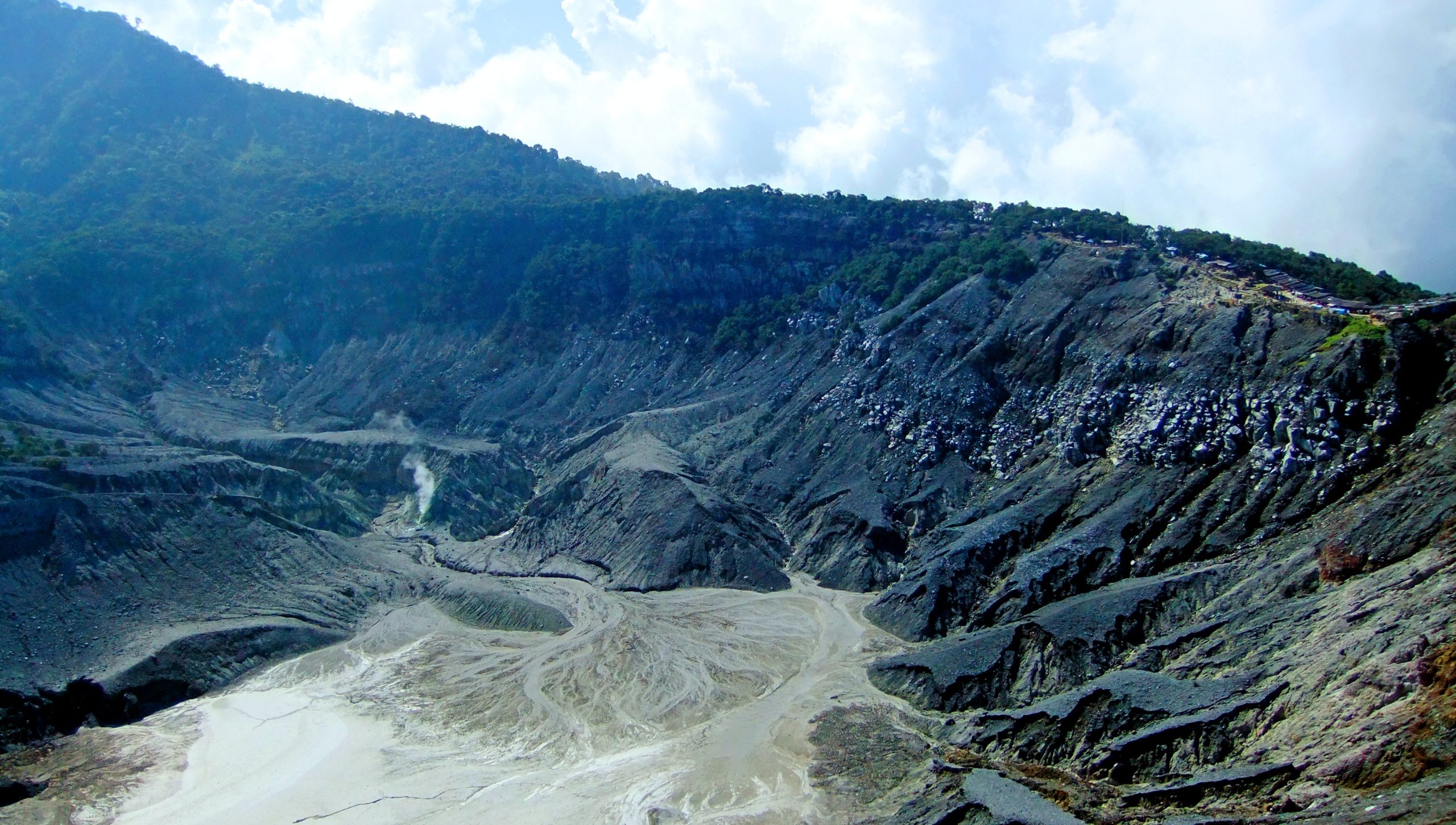
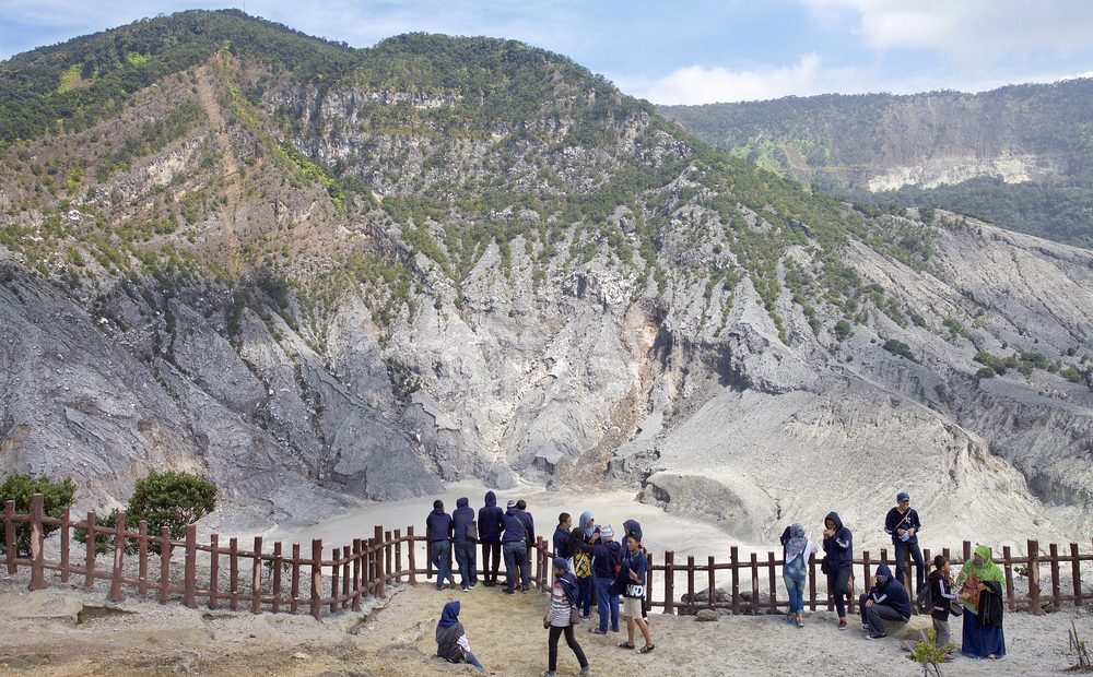
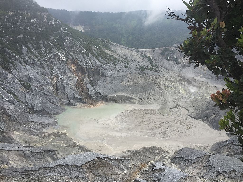
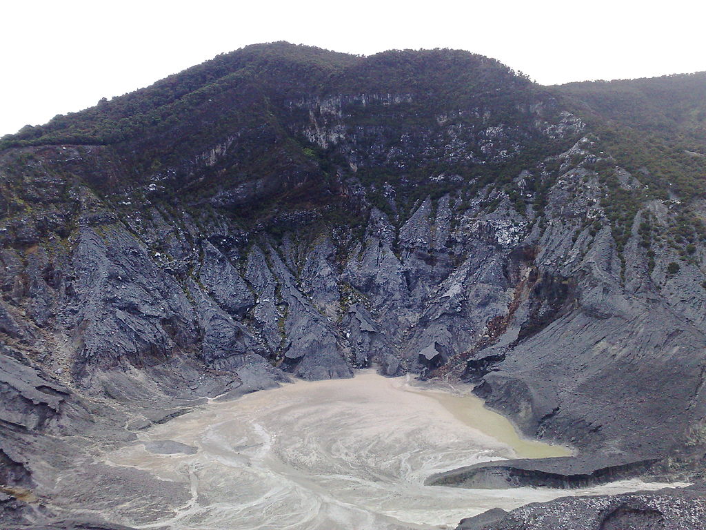
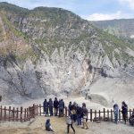
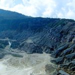
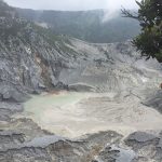
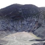
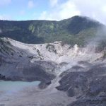
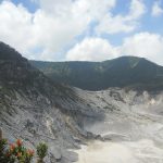
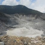
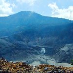
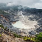
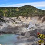
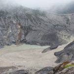
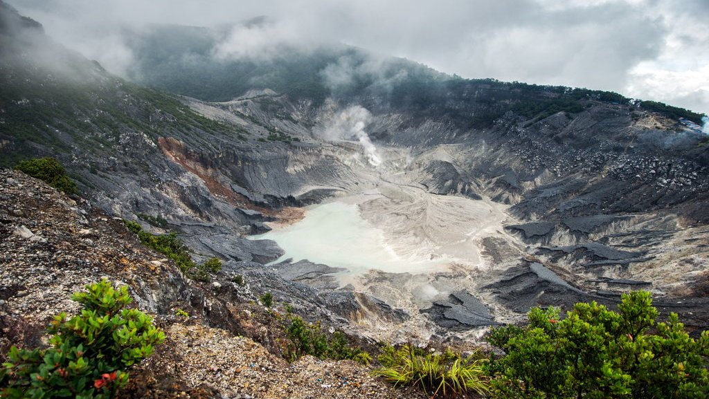
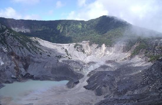
Throughout its history, the activities that occurred on Mount Tangkuban Parahu have formed 13 craters. Three of these craters are popular as tourist destinations, namely Ratu Crater, Upas Crater and Domas Crater.
Mount Tangkuban Parahu was formed around 90,000 years ago in the Sunda Caldera. This mountain, is younger than Mount Burangrang. Mount Burangrang, which is located on the west side of Mount Tangkuban Parahu, was formed around 210,000 to 105,000 years ago. Mount Tangkuban Parahu was born after the formation of the Lembang Fault. When Mount Tangkuban Parahu erupted, some of the material that flowed to the south was stuck at the foot of the fault.
Throughout its history, the activities that occurred on Mount Tangkuban Parahu have formed 13 craters. Three of these craters are popular as tourist destinations, namely Ratu Crater, Upas Crater and Domas Crater.
 While the complete details of the 13 craters are as follows: Upas Crater consists of Upas Crater (youngest), Upas Crater (young), and Upas Crater (old). Ratu Crater also consists of Ratu Crater (1920), Ratu Crater (young), and Ratu Crater (old). Then there are new craters, Pangguyanganbadak Crater, Badak Crater, Ecoma Crater, Jurig Crater, Siluman Crater, and Domas Crater.
Mount Tangkuban Parahu had erupted several times. The person who recorded its first eruption was a botanist and geologist named Franz Wilhelm Junghuhn. Based on the records made by Junghuhn in 1853, the first record of the eruption of Mount Tangkuban Parahu was in 1829. There is no data about previous eruptions. After that the eruption rested for 17 years, the next eruption occurred in 1846.
While the complete details of the 13 craters are as follows: Upas Crater consists of Upas Crater (youngest), Upas Crater (young), and Upas Crater (old). Ratu Crater also consists of Ratu Crater (1920), Ratu Crater (young), and Ratu Crater (old). Then there are new craters, Pangguyanganbadak Crater, Badak Crater, Ecoma Crater, Jurig Crater, Siluman Crater, and Domas Crater.
Mount Tangkuban Parahu had erupted several times. The person who recorded its first eruption was a botanist and geologist named Franz Wilhelm Junghuhn. Based on the records made by Junghuhn in 1853, the first record of the eruption of Mount Tangkuban Parahu was in 1829. There is no data about previous eruptions. After that the eruption rested for 17 years, the next eruption occurred in 1846.
Mount Tangkuban Parahu was formed around 90,000 years ago in the Sunda Caldera. This mountain, is younger than Mount Burangrang. Mount Burangrang, which is located on the west side of Mount Tangkuban Parahu, was formed around 210,000 to 105,000 years ago. Mount Tangkuban Parahu was born after the formation of the Lembang Fault. When Mount Tangkuban Parahu erupted, some of the material that flowed to the south was stuck at the foot of the fault.
Throughout its history, the activities that occurred on Mount Tangkuban Parahu have formed 13 craters. Three of these craters are popular as tourist destinations, namely Ratu Crater, Upas Crater and Domas Crater.
While the complete details of the 13 craters are as follows: Upas Crater consists of Upas Crater (youngest), Upas Crater (young), and Upas Crater (old). Ratu Crater also consists of Ratu Crater (1920), Ratu Crater (young), and Ratu Crater (old). Then there are new craters, Pangguyanganbadak Crater, Badak Crater, Ecoma Crater, Jurig Crater, Siluman Crater, and Domas Crater.
Mount Tangkuban Parahu had erupted several times. The person who recorded its first eruption was a botanist and geologist named Franz Wilhelm Junghuhn. Based on the records made by Junghuhn in 1853, the first record of the eruption of Mount Tangkuban Parahu was in 1829. There is no data about previous eruptions. After that the eruption rested for 17 years, the next eruption occurred in 1846.
 After that the volcano was recorded as active in 1867 and 1887 respectively. The next major eruption occurred in 1896 after the mountain experienced a 50 year rest period. Later activity or eruptions occurred in 1910, 1929, 1935, 1946, 1947, 1950, 1952, 1957, 1961, 1965, 1967, 1969, 1971, 1983, 1992, 1994, 2004 and 2019. The rest period between the eruption of Mount Tangkuban Parahu lasted between 30 – 70 years.
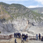
 In 2005, the Center for Volcanology and Regional Geological Hazard Mitigation made a map of the Mount Tangkuban Parahu Disaster Prone Area.
Disaster-prone areas are divided into three categories. Each Disaster Prone Areas I, II, and III. There are those within a radius of 1 km, 5 km from the eruption, and those that have the potential to be hit by lava and ash rain or ejected incandescent rocks.
In the Bandung Purba book it is stated that valleys that have the potential to be hit by lava include Ciasem, Cimuji, Cikole, Cibogo, Cikapundung, Cihideung, Cibeureum and Cimahi.
In 2005, the Center for Volcanology and Regional Geological Hazard Mitigation made a map of the Mount Tangkuban Parahu Disaster Prone Area.
Disaster-prone areas are divided into three categories. Each Disaster Prone Areas I, II, and III. There are those within a radius of 1 km, 5 km from the eruption, and those that have the potential to be hit by lava and ash rain or ejected incandescent rocks.
In the Bandung Purba book it is stated that valleys that have the potential to be hit by lava include Ciasem, Cimuji, Cikole, Cibogo, Cikapundung, Cihideung, Cibeureum and Cimahi. 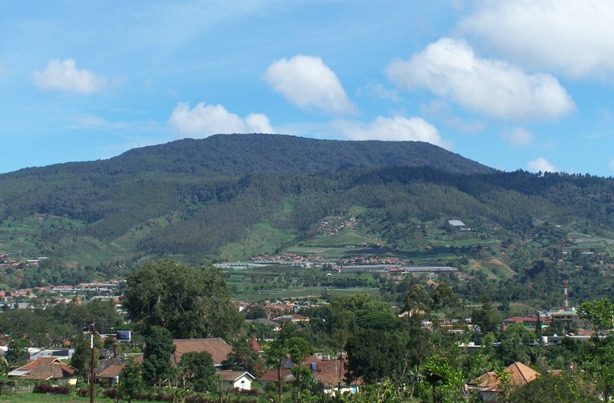 Legend
Main article: Sangkuriang
The name translates roughly to “upturning of (a) boat” or “upturned boat” in Sundanese, referring to the local legend of its creation. The story tells of “Dayang Sumbi”, a beauty who lived in West Java. She cast away her son “Sangkuriang” for disobedience, and in her sadness was granted the power of eternal youth by the gods.
After many years in exile, Sangkuriang decided to return to his home, long after the two had forgotten and failed to recognise each other. Sangkuriang fell in love with Dayang Sumbi, his mother, and planned to marry her, only for Dayang Sumbi to recognise his birthmark just as he was about to go hunting wild boar.
To prevent the marriage from taking place, Dayang Sumbi asked Sangkuriang to build a dam on the river Citarum and to build a large boat to cross the river, both before the sunrise. Sangkuriang meditated and summoned mythical ogre-like creatures -buto ijo or green giant(s)- to do his bidding. Dayang Sumbi saw that the tasks were almost completed and called on her workers to spread red silk cloths east of the city, to give the impression of impending sunrise. Sangkuriang was fooled, and upon believing that he had failed, kicked the dam and the unfinished boat, resulting in severe flooding and the creation of Tangkuban Perahu from the hull of the boat.
Legend
Main article: Sangkuriang
The name translates roughly to “upturning of (a) boat” or “upturned boat” in Sundanese, referring to the local legend of its creation. The story tells of “Dayang Sumbi”, a beauty who lived in West Java. She cast away her son “Sangkuriang” for disobedience, and in her sadness was granted the power of eternal youth by the gods.
After many years in exile, Sangkuriang decided to return to his home, long after the two had forgotten and failed to recognise each other. Sangkuriang fell in love with Dayang Sumbi, his mother, and planned to marry her, only for Dayang Sumbi to recognise his birthmark just as he was about to go hunting wild boar.
To prevent the marriage from taking place, Dayang Sumbi asked Sangkuriang to build a dam on the river Citarum and to build a large boat to cross the river, both before the sunrise. Sangkuriang meditated and summoned mythical ogre-like creatures -buto ijo or green giant(s)- to do his bidding. Dayang Sumbi saw that the tasks were almost completed and called on her workers to spread red silk cloths east of the city, to give the impression of impending sunrise. Sangkuriang was fooled, and upon believing that he had failed, kicked the dam and the unfinished boat, resulting in severe flooding and the creation of Tangkuban Perahu from the hull of the boat.