
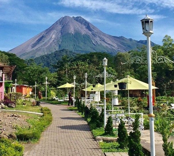
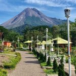
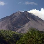
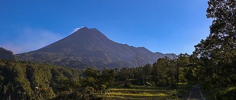
![]() Taman Nasional Gunung Merapi (TNGM), Mount Merapi National Park is a national park located in central Java. Administratively, this national park area is included in the territory of two provinces, namely Central Java and Yogyakarta. The designation of the Mount Merapi National Park area was carried out by Decree of the Minister of Forestry 134/Menhut-II/2004 dated May 4, 2004.
Taman Nasional Gunung Merapi (TNGM), Mount Merapi National Park is a national park located in central Java. Administratively, this national park area is included in the territory of two provinces, namely Central Java and Yogyakarta. The designation of the Mount Merapi National Park area was carried out by Decree of the Minister of Forestry 134/Menhut-II/2004 dated May 4, 2004.
The management objective is the protection of water sources, rivers and life support systems in the regencies/cities of Sleman, Yogyakarta, Klaten, Boyolali, and Magelang. Meanwhile, before the formation of the National Park Management Center, TNGM was under the management of the Yogyakarta Natural Resources Conservation Agency (Konservasi Sumber Daya Alam – KSDA).
 Location and area
The geographical position of the Mount Merapi National Park area is between coordinates 07°22’33” – 07°52’30” South Latitude and 110°15’00” – 110°37’30” East Longitude. While the total area is around 6,410 ha, with 5,126.01 ha in Central Java and 1,283.99 ha in the Special Region of Yogyakarta. The Mount Merapi National Park area includes the districts of Magelang, Boyolali and Klaten in Central Java, as well as Sleman in Yogyakarta.
 Regional history
The forests of Mount Merapi have been designated as protected areas since 1931 to protect water sources, rivers and to support the life systems of the regencies/cities of Sleman, Yogyakarta, Klaten, Boyolali, and Magelang.
Before being appointed as Mount Merapi National Park, the forest area in the province of Special Region of Yogyakarta consisted of protected forest functions covering an area of 1,041.38 ha, the Plawangan Turgo nature reserve (Cagar Alam – CA) 146.16 ha; and natural tourism park (Taman Wisata Alam – TWA) Plawangan Turgo 96.45 ha. The forest area in Central Java, which is included in the National Park area, is a protected forest covering an area of 5,126 ha.
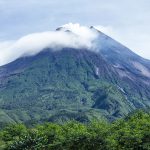
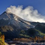
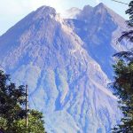
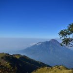
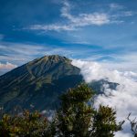


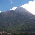
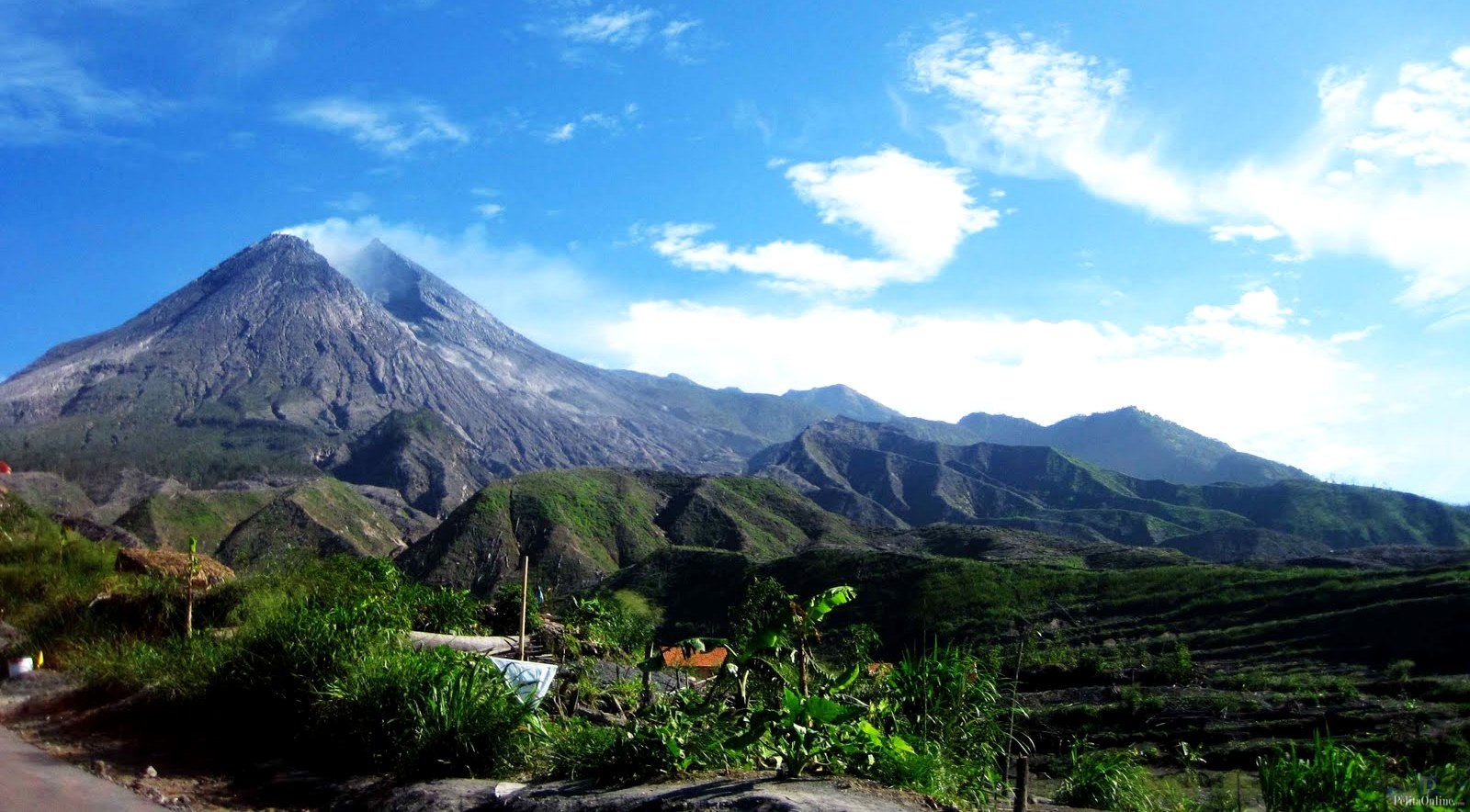
 Topography. The area of Mount Merapi National Park is located at an altitude between 600 – 2,968 m above sea level. The topography of the area ranges from sloping to hilly and mountainous. To the north there is a plateau that narrows between two mountains, namely Mount Merapi and Mount Merbabu around Selo District, Boyolali.
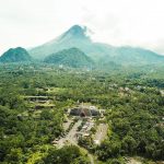
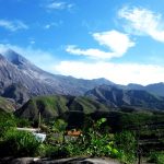
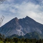
 In the southern part, the slopes of Merapi continue to descend and slope to the south coast on the edge of the Indian Ocean, crossing the city of Yogyakarta. Before the foot of the mountain, there are two hills, namely Turgo Hill and Plawangan Hill, which are part of the Kaliurang tourist area.
Type of soil. The soil types in this area are regosol, andosol, alluvial and litosol. Regosol soil, which is a young soil type, is mainly located in the Yogyakarta area. Soil parent material is volcanic material, which develops on the physiography of mountain slopes. Andosol soil types are found in Selo and Cepogo sub-districts, Boyolali.
 Climate. The climate type in this area is type C according to the Schmidt and Ferguson rainfall classification, which is slightly wet with a Q value between 33.3% – 66%. The amount of rainfall varies between 875-2527 mm per year. The variation of rainfall in each district is as follows:
Magelang: 2,252 – 3,627 mm/yr.;
Boyolali: 1,856 – 3,136 mm/yr.;
Klaten: 902 – 2,490 mm/yr.; and
Sleman: 1,869.8 – 2,495 mm/yr.
Climate. The climate type in this area is type C according to the Schmidt and Ferguson rainfall classification, which is slightly wet with a Q value between 33.3% – 66%. The amount of rainfall varies between 875-2527 mm per year. The variation of rainfall in each district is as follows:
Magelang: 2,252 – 3,627 mm/yr.;
Boyolali: 1,856 – 3,136 mm/yr.;
Klaten: 902 – 2,490 mm/yr.; and
Sleman: 1,869.8 – 2,495 mm/yr.
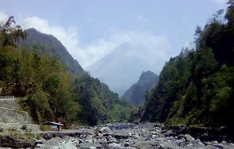
Hydrology. The Mount Merapi area is the source for three watersheds (watersheds), namely the Progo watershed in the west; Opak watershed in the south and Bengawan Solo watershed in the east. Overall, there are about 27 rivers around Mount Merapi that flow into the three watersheds.