
 Sleman (Javanese: , translate; Sléman) is a district in the Special Region of Yogyakarta, Indonesia. The capital of this district is in Kapanewon Sleman. Sleman is known as the origin of the salak pondoh fruit.
This regency is bordered by Central Java Province (Magelang Regency, Boyolali Regency, and Klaten Regency) in the north and east, Gunungkidul Regency, Bantul Regency and Yogyakarta City in the south, and Kulon Progo Regency in the west. The government center is in Kapanewon Sleman, which is on the main route between Yogyakarta – Semarang.
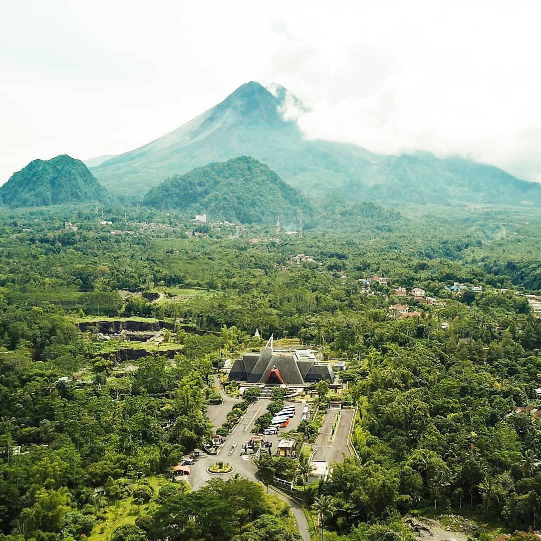
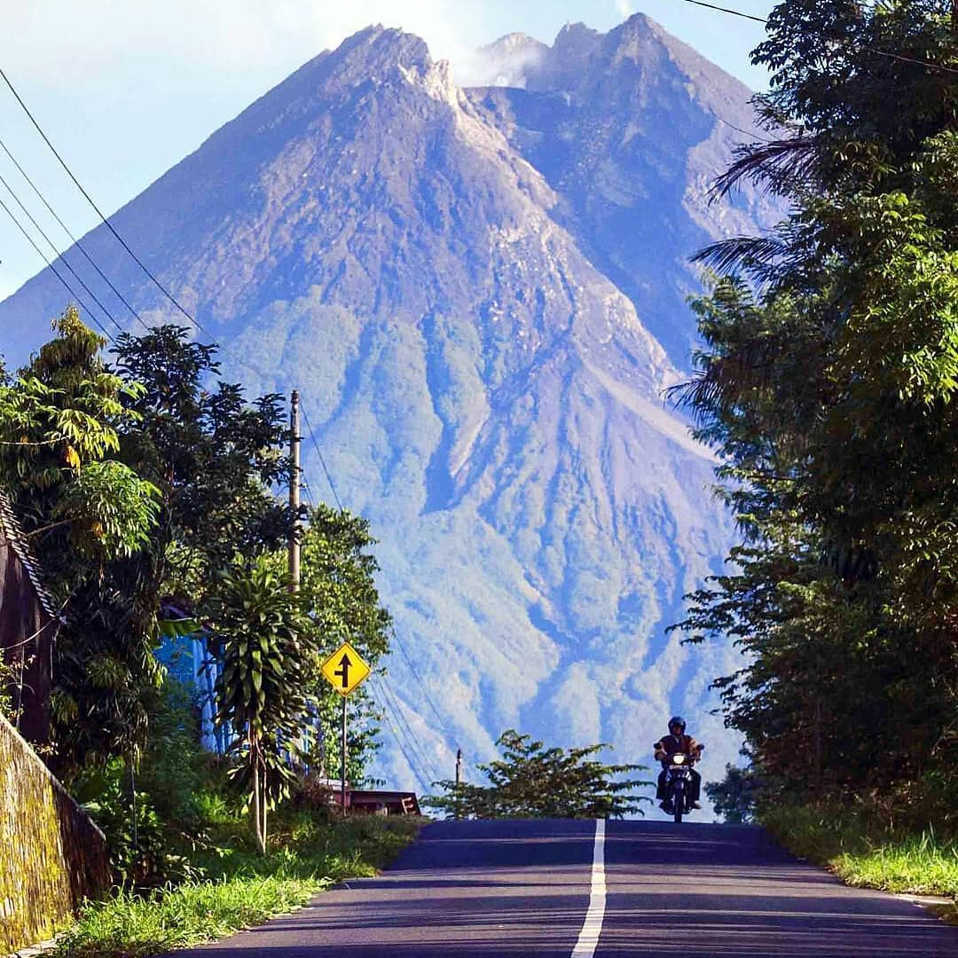
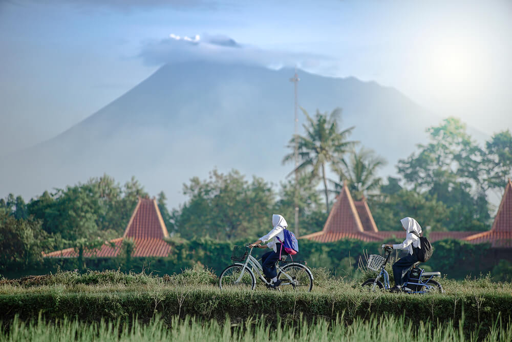
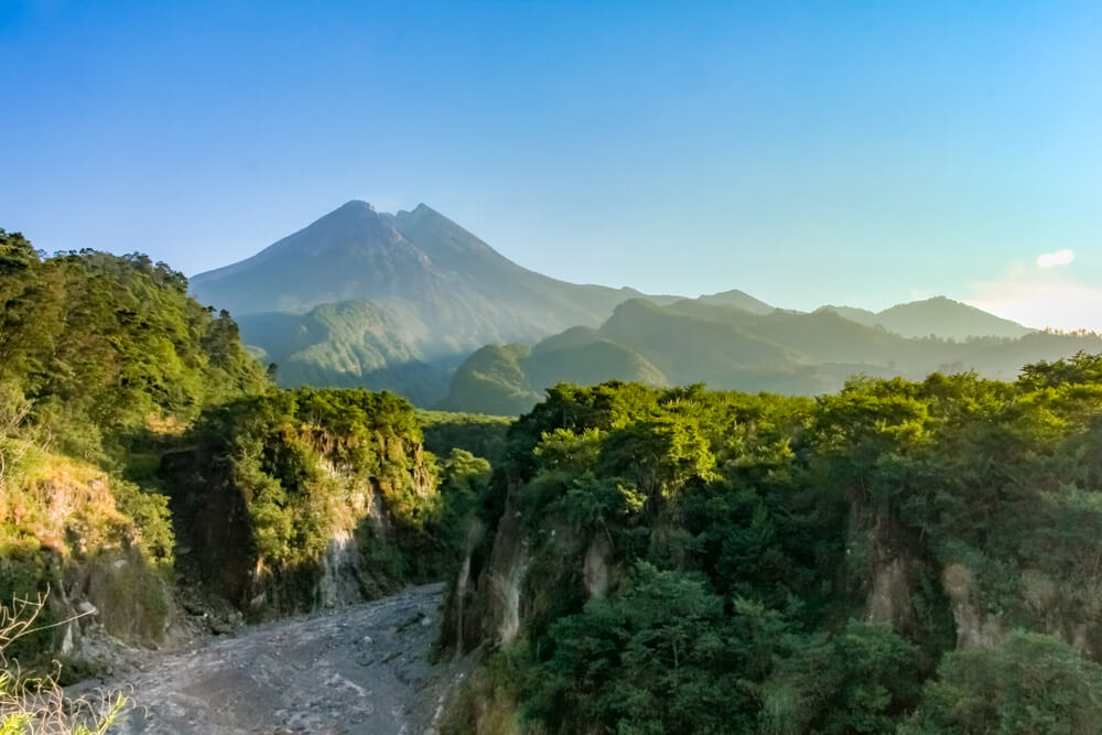
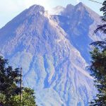
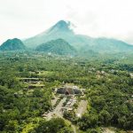
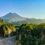
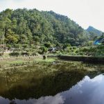
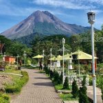
The northern part of the district is mountainous, with the peak of Mount Merapi on the border with Central Java, one of the most dangerous active volcanoes on the island of Java. While in the south is a fertile lowland. Among the major rivers that cross this district are the Progo River (limiting Sleman Regency to Kulon Progo Regency), Code River, Kuning River, Opak River and Tapus River.
With Regional Original Income Rp. 52,978,731,000,- (2005) Sleman Regency is the richest regency in the Special Region of Yogyakarta.
 Geography
Geographically, Sleman Regency is located between 110° 33′ 00″ and 110° 13′ 00″ East Longitude, 7° 34′ 51″ and 7° 47′ 30″ South Latitude. Sleman Regency is bordered by Boyolali Regency in the north, Central Java Province, in the east by Klaten Regency, Central Java Province, in the west by Kulon Progo Regency, DIY Province and Magelang Regency, Central Java Province and in the south by Yogyakarta City. Bantul Regency and Gunung Kidul Regency, Yogyakarta Province.
 Area
Area
The area of Sleman Regency is 57,482 Ha or 574.82 Km2 or about 18% of the area of the Special Province of Jogjakarta 3,185.80 Km2, with the farthest distance from North to South 32 Km, East to West 35 Km. Administratively, it consists of 17 sub-districts, 86 villages, and 1,212 hamlets.
Topography
In Sleman Regency, the land condition in the southern part is relatively flat, except for the hilly areas in the southeastern part of Prambanan District and partly in Gamping District. The north is relatively sloping and in the north around the slopes of Merapi is relatively steep and there are about 100 springs. Almost half of the area is fertile agricultural land supported by technical irrigation in the west and south. Topography can be distinguished on the basis of altitude and land slope (slope).
 Height
The altitude of Sleman Regency ranges from < 100 to > 1000 m above sea level. The height of the land can be divided into three classes, namely altitude < 100 m, 100 – 499 m, 500 – 999 m and > 1000 m above sea level.
Altitude < 100 m above sea level covering an area of 6,203 ha or 10.79% of the total area located in the Districts of Moyudan, Minggir, Godean, Prambanan, Gamping and Berbah. Altitude > 100 – 499 m above sea level covering an area of 43,246 ha or 75.32% of the total area, located in 17 sub-districts.
 Altitude > 500 – 999 m above sea level covers an area of 6,538 ha or 11.38% of the total area, covering the Districts of Tempel, Turi, Pakem and Cangkringan. Altitude > 1000 m above sea level covering an area of 1,495 ha or 2.60% of the total area covering the Districts of Turi, Pakem, and Cangkringan.
Land Slope (Slope)
From the topographic map with a scale of 1: 50,000, it can be seen the height and horizontal distance to calculate the slope (slope). The results of the map analysis in the form of land slope data are classified into 4 (four) classes, namely slope 0 – 2 %; > 2 – 15 %; > 15 – 40 %; and > 40%.
Slope 0 – 2% is found in 15 (fifteen) sub-districts covering an area of 34,128 ha or 59.32% of the entire slope area, > 2 – 15 % is found in 13 (thirteen) subdistricts with a slope area of 18,192 or 31.65% of total area.
 The slope of land > 15-40% is found in 12 (twelve) sub-districts, the area of this slope is 3,546 ha or 6.17%, slopes > 40 % are in the Godean, Gamping, Berbah, Prambanan, Turi, Pakem and Cangkringan sub-districts with an area of 1,616 ha or 2.81%.
Climate
The area of Sleman Regency includes a wet tropical climate with a rainy season between November – April and a dry season between May – October. In 2000 the number of rainy days of 25 days occurred in March, however, the average amount of rainfall in February was 16.2 mm with a number of rainy days of 20 days.
 The relative humidity of the air in 2000 was the lowest in August of 74% and the highest in March and November of 87% respectively, while the lowest air temperature was 26.1 degrees Celsius in January and November and the highest air temperature was 27, 4 degrees Celsius in September.
Land Usage
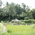
Land Almost half of the area is fertile agricultural land supported by technical irrigation in the west and south. The state of the soil type is distinguished into rice fields, fields, yards, forests, and others. The development of land use over the last 5 years shows that the type of rice fields decreased by an average of 0.96% per year, uplands increased by 0.82%, yards increased by 0.31%, and others decreased by 1.57%.
Regency of a Thousand Temples. Sleman Regency in the Special Region of Yogyakarta deserves to be called the Regency of a Thousand Temples. There are more than 10 temples scattered in the Sleman Regency area. The majority of temples in Sleman are Hindu-style which are usually dedicated to certain gods. In each temple there is generally a hollow space in the middle to place a statue of a god that is used as an offering. The following are 10 selected temples that can be visited in Sleman Regency.
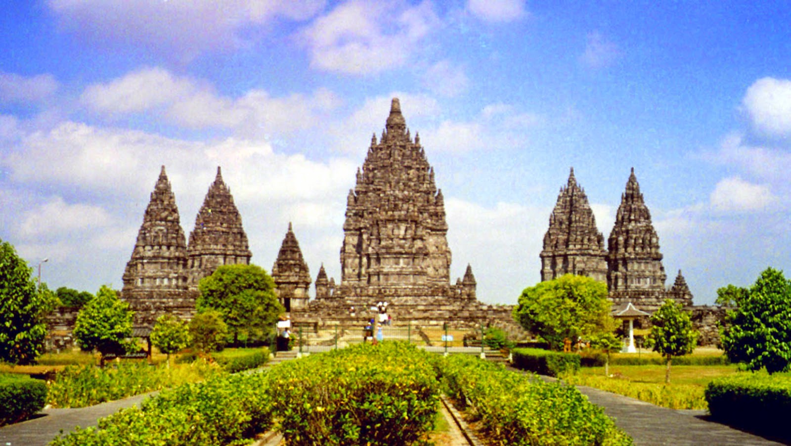
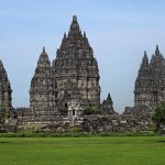
Candi Prambanan or Candi Roro Jonggrang (Javanese: ꦕꦤ꧀ꦝꦶ ꦥꦿꦩ꧀ꦧꦤꦤ꧀, translate: Candhi Prambanan) is the largest Hindu temple complex in Indonesia which was built in the 9th century AD. This temple is dedicated to Trimurti, the three main Hindu gods, namely Brahma as the creator god, Vishnu as the god of preservation, and Shiva as the god of destruction.
Based on the Siwagrha inscription, the original name of this temple complex is Siwagrha (Sanskrit which means ‘Shiva’s House’), and indeed in the garbagriha (main room) of this temple resides a three-meter tall Shiva Mahadeva statue which shows that in this temple Lord Shiva is preferred.
This temple complex is located in Prambanan, Sleman, Special Region of Yogyakarta, and Prambanan districts, Klaten Regency, Central Java, approximately 17 kilometers northeast of Yogyakarta, 50 kilometers southwest of Surakarta and 120 kilometers south of Semarang, right on the border between Central Java province, and the Special Region of Yogyakarta. Its location is very unique, Prambanan Temple is located in the administrative area of the village of Bokoharjo, Prambanan, Sleman, while the entrance to the Prambanan Temple complex is located in the administrative area of the village of Tlogo, Prambanan, Klaten.
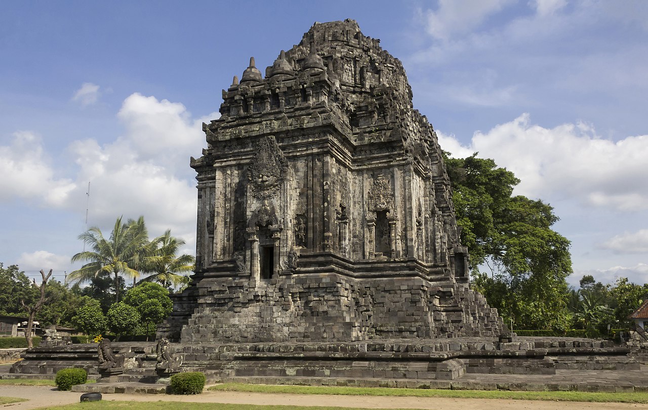 Kalasan
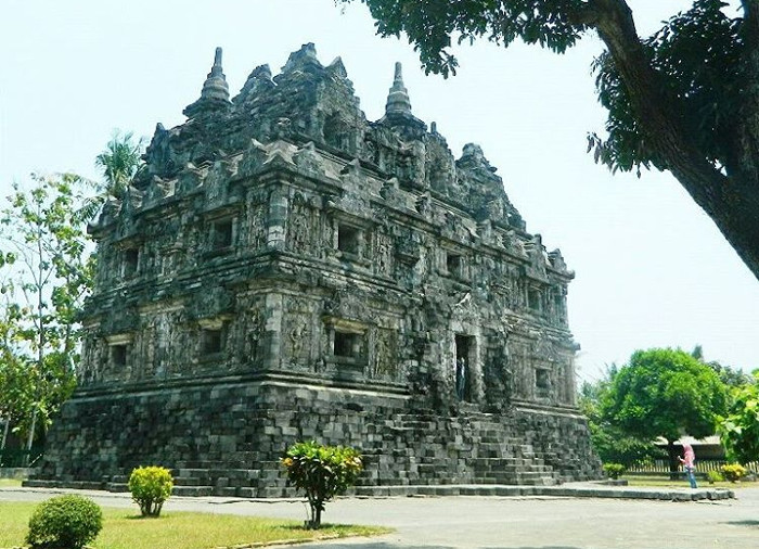
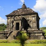
Kalasan Temple or Kalibening Temple (Javanese: ꦏꦭꦱꦤ꧀, translit. Candi Kalasan) is a Cultural Heritage Building which is categorized as a Buddhist temple. This temple is located in Tirtomartani Village, Kalasan District, Sleman Regency, Special Region of Yogyakarta, Indonesia.
This temple has 52 stupas and is located on the south side of the highway between Yogyakarta and Solo and about 2 km from Prambanan temple. At first only this Kalasan temple was found in the area of this site, but after digging deeper, more supporting buildings were found around this temple. In addition to the Kalasan temple and other supporting buildings, there are also three small temples outside the main temple building, in the form of a stupa.
Based on the Kalasan inscription dated 778 which was found not far from this temple, it mentions the construction of a sacred building to honor the female Bodhisattva, Tarabhawana and a monastery for priests. The ruler who ruled the construction of this temple was named Maharaja Tejapurnapana Panangkaran (Rakai Panangkaran) from the Syailendra family. Then by comparison of the manuscripts on the Kelurak inscription this figure can be identified with Dharanindra or with the inscription Nalanda is the father of Samaragrawira. So that this temple can be proof of the presence of the Syailendra dynasty.
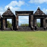
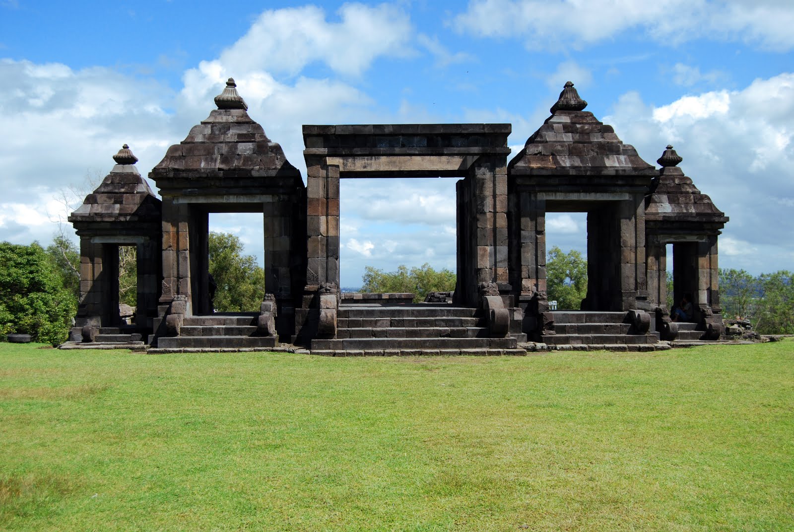 Ratu Boko
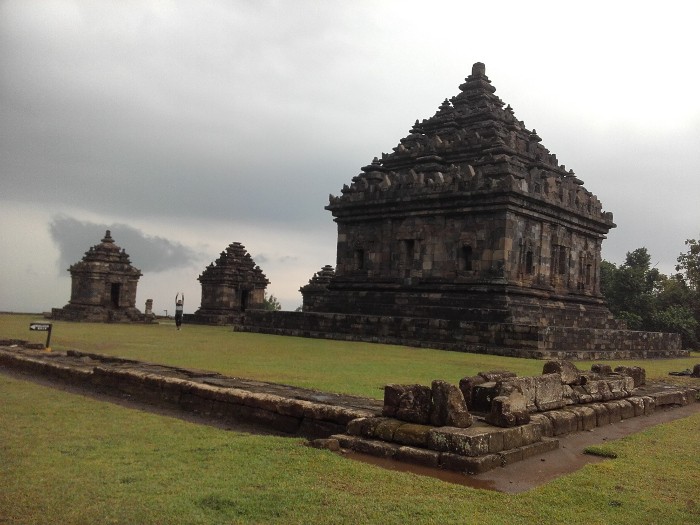
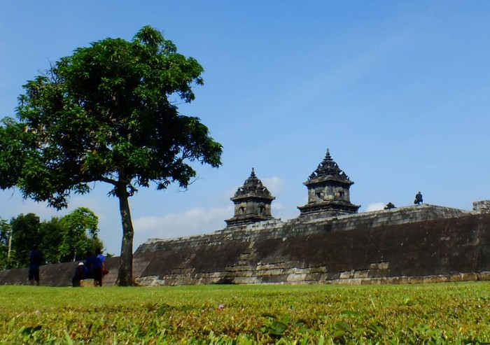
Ratu Boko site or King Baka Palace (Javanese: ꦫꦠꦸꦧꦏ, translit. Ratu Baka Palace) is an archaeological site which is a complex of a number of remnants of buildings located approximately 3 km south of the Prambanan Temple complex, 18 km east east of Yogyakarta City or 50 km southwest of Surakarta City, Central Java province, more precisely in the village of Bokoharjo, Kapanéwon Prambanan, Sleman district, Special Region of Yogyakarta. Ratu Boko site is located on a hill at an altitude of 196 meters above sea level. The total area of the complex is about 25 ha.
This site displays attributes as a place of activity or a king’s residence/residence site. Ratu Boko is thought to have been used by people in the 8th century during the Sailendra dynasty (Rakai Panangkaran) of the Medang Kingdom (Hindu Mataram Period). Judging from the pattern of laying the remains of the building, it is strongly suspected that this site is a former palace (king’s palace). This opinion is based on the fact that this complex is not a temple or a building with a religious nature, but a fortified palace with evidence of the remains of fort walls and dry moats as defensive structures. Remains of residential settlements were also found around the location of this site.
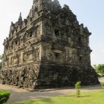
 Sambisari
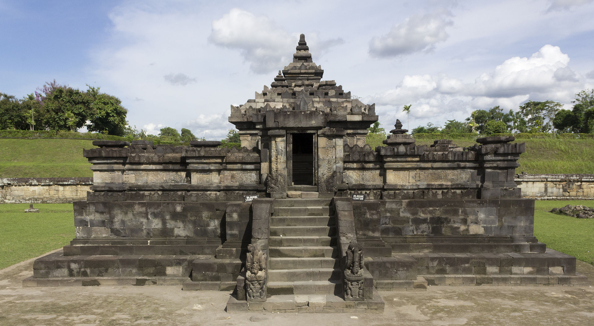
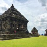
 Temple (Javanese: ꦱꦩ꧀ꦧꦶꦱꦫꦶ, translit. Candi Sambisari) is a Hindu (Shiva) temple located in Purwomartani, Kalasan, Sleman, Special Region of Yogyakarta. Its position is about 12 km east of the city of Yogyakarta towards the city of Solo or about 4 km west of the Prambanan Temple complex.
This temple is estimated to have been built in the early decades of the 9th century during the reign of King Rakai Garung who ruled in the Ancient Mataram Kingdom of the Syailendra dynasty. This estimate is based on the inscription style of a gold plate that reads “om shiva shtana” found in 1977 in this temple complex, as well as information from the Wanua Tengah III inscription which states that Rakai Garung ruled Medang in the early 9th century.
This temple was discovered accidentally in 1966 by a farmer in Sambisari Hamlet, Purwomartani Village. After being examined by the Yogyakarta Archeology Center, it was decided that this finding was in the form of a temple complex. The restoration was carried out after that and was completed in 1986. The name of this hamlet was later immortalized as the name of the temple. The position of the base of the Sambisari Temple was 6.5 meters below ground level when it was found, most likely because it was buried by lava from Mount Merapi which erupted and caused a catastrophic disaster in the early 11th century (possibly in 1006). This can be seen from the many volcanic rocks around the temple.
Sambisari
Sambisari Temple (Javanese: ꦱꦩ꧀ꦧꦶꦱꦫꦶ, translit. Candi Sambisari) is a Hindu (Shiva) temple located in Purwomartani, Kalasan, Sleman, Special Region of Yogyakarta. Its position is about 12 km east of the city of Yogyakarta towards the city of Solo or about 4 km west of the Prambanan Temple complex.
This temple is estimated to have been built in the early decades of the 9th century during the reign of King Rakai Garung who ruled in the Ancient Mataram Kingdom of the Syailendra dynasty. This estimate is based on the inscription style of a gold plate that reads “om shiva shtana” found in 1977 in this temple complex, as well as information from the Wanua Tengah III inscription which states that Rakai Garung ruled Medang in the early 9th century.
This temple was discovered accidentally in 1966 by a farmer in Sambisari Hamlet, Purwomartani Village. After being examined by the Yogyakarta Archeology Center, it was decided that this finding was in the form of a temple complex. The restoration was carried out after that and was completed in 1986. The name of this hamlet was later immortalized as the name of the temple. The position of the base of the Sambisari Temple was 6.5 meters below ground level when it was found, most likely because it was buried by lava from Mount Merapi which erupted and caused a catastrophic disaster in the early 11th century (possibly in 1006). This can be seen from the many volcanic rocks around the temple.
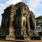
 Ijo
Candi Ijo (Javanese: ꦆꦗꦺꦴ, translit. Candi Ijo) is a Hindu-style temple complex, located 4 kilometers southeast of Ratu Boko Temple or about 18 kilometers east of the city of Yogyakarta. This temple is estimated to have been built between the 10th and 11th centuries AD during the Medang Kingdom period of the Mataram period.
Ijo Temple is located in Groyokan Hamlet, Sambirejo Village, Prambanan District, Sleman Regency, Special Region of Yogyakarta. This temple is located on the western slope of a hill that is still part of the Batur Agung hills, about 4 kilometers southeast of Ratu Boko Temple. Where at the bottom of the slope there is a tour of the Breksi Jogja cliff which is a former natural stone mining. Its position is on a hillside with an average height of 425 meters above sea level. This temple is called “Ijo” because it is located on a hill called Gumuk Ijo. The temple complex opens to the west with a beautiful panorama, in the form of rice fields and landscapes, such as Adisucipto Airport and Parangtritis Beach.
The plain where the main temple complex is located has an area of about 0.8 hectares, but it is strongly suspected that the Ijo temple complex is much wider, and protrudes to the west and north. This assumption is based on the fact that when the hillsides of Candi Ijo in the east and north were mined by residents, many artifacts related to the temple were found.
Ijo
Candi Ijo (Javanese: ꦆꦗꦺꦴ, translit. Candi Ijo) is a Hindu-style temple complex, located 4 kilometers southeast of Ratu Boko Temple or about 18 kilometers east of the city of Yogyakarta. This temple is estimated to have been built between the 10th and 11th centuries AD during the Medang Kingdom period of the Mataram period.
Ijo Temple is located in Groyokan Hamlet, Sambirejo Village, Prambanan District, Sleman Regency, Special Region of Yogyakarta. This temple is located on the western slope of a hill that is still part of the Batur Agung hills, about 4 kilometers southeast of Ratu Boko Temple. Where at the bottom of the slope there is a tour of the Breksi Jogja cliff which is a former natural stone mining. Its position is on a hillside with an average height of 425 meters above sea level. This temple is called “Ijo” because it is located on a hill called Gumuk Ijo. The temple complex opens to the west with a beautiful panorama, in the form of rice fields and landscapes, such as Adisucipto Airport and Parangtritis Beach.
The plain where the main temple complex is located has an area of about 0.8 hectares, but it is strongly suspected that the Ijo temple complex is much wider, and protrudes to the west and north. This assumption is based on the fact that when the hillsides of Candi Ijo in the east and north were mined by residents, many artifacts related to the temple were found.
 Barong
Candi Barong (Javanese: ꦧꦫꦺꦴꦁ, translate. Candi Barong) is a temple with a Hindu religious background located in the southeast of Ratu Boko Complex, Prambanan, Sleman. Barong Temple is located on a hill in Candisari Hamlet, Sambirejo Village, Prambanan, Sleman Regency, Special Region of Yogyakarta.
Barong Temple is estimated to have been built around the 9th and 10th centuries AD, as a relic of the Medang Kingdom of the Mataram period. This temple was rediscovered in the early 20th century in a state of collapse during the expansion of sugar cane plantations for the manufacture of sugar factories by a Dutchman.
The name barong was given by the community because there is a kala decoration in the recesses of the temple body that resembles a barongan, a mystical creature in Javanese mythology. Barong Temple also has another name, namely Sari Suragedug Temple. This name is written on the Ratu Baka Inscription in Sanskrit. In the inscription, it is said that a king named Sri Kumbaja built three lingas named Krttiwasalingga, Triyarbakalingga, and Haralingga. When the phallus was built with the companions of Dewi Sri, Dewi Suralaksmi, and Dewi Mahalaksmi. The three lingas mentioned are probably Barong Temples.
In the Pereng Inscription dated 863 AD it is written that Rakai Walaing Pu Kumbhayoni gave rice fields and two hills in Tamwahurang in 784 Saka or 860 AD. The rice fields and hills were given for the maintenance of Shiva’s sacred building called Bhadraloka. According to expert opinion, the building refers to the Barong Temple.
Barong
Candi Barong (Javanese: ꦧꦫꦺꦴꦁ, translate. Candi Barong) is a temple with a Hindu religious background located in the southeast of Ratu Boko Complex, Prambanan, Sleman. Barong Temple is located on a hill in Candisari Hamlet, Sambirejo Village, Prambanan, Sleman Regency, Special Region of Yogyakarta.
Barong Temple is estimated to have been built around the 9th and 10th centuries AD, as a relic of the Medang Kingdom of the Mataram period. This temple was rediscovered in the early 20th century in a state of collapse during the expansion of sugar cane plantations for the manufacture of sugar factories by a Dutchman.
The name barong was given by the community because there is a kala decoration in the recesses of the temple body that resembles a barongan, a mystical creature in Javanese mythology. Barong Temple also has another name, namely Sari Suragedug Temple. This name is written on the Ratu Baka Inscription in Sanskrit. In the inscription, it is said that a king named Sri Kumbaja built three lingas named Krttiwasalingga, Triyarbakalingga, and Haralingga. When the phallus was built with the companions of Dewi Sri, Dewi Suralaksmi, and Dewi Mahalaksmi. The three lingas mentioned are probably Barong Temples.
In the Pereng Inscription dated 863 AD it is written that Rakai Walaing Pu Kumbhayoni gave rice fields and two hills in Tamwahurang in 784 Saka or 860 AD. The rice fields and hills were given for the maintenance of Shiva’s sacred building called Bhadraloka. According to expert opinion, the building refers to the Barong Temple.
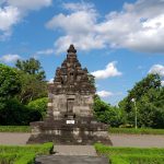
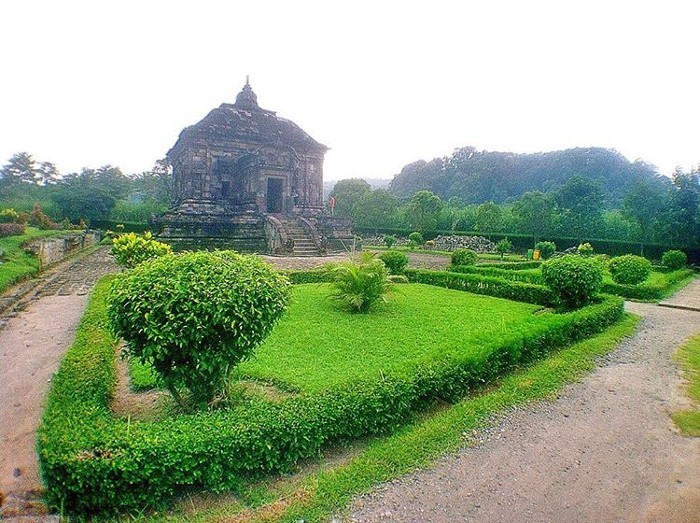
 Sari
Candi Sari, also known as Candi Bendah (Javanese: ꦱꦫꦶ, translit. Candi Sari) is a Buddhist temple located not far from Sambisari Temple, Kalasan Temple and Prambanan Temple, which is in the northeastern part of the city of Yogyakarta, and not so far away. from Adisucipto Airport, more precisely in Tirtomartani Village, Kalasan District, Sleman Regency, Special Region of Yogyakarta. This temple was built around the 8th and 9th centuries at the time of the Ancient Mataram Kingdom with a very beautiful shape. At the top of this temple there are 9 stupas as seen in the stupa at Borobudur Temple, and arranged in 3 parallel rows.
The shape of the temple building and the relief carvings on the temple walls are very similar to the reliefs in Plaosan Temple. Several two-story rooms are directly below each stupa, and are thought to have been used as meditation places for Buddhist priests (monks) in ancient times. Candi Sari in the past was a Buddhist monastery, and was used as a place of study and study for monks.
According to estimates this temple was built in the 8th century AD along with the construction of the Kalasan Temple, namely during the reign of Rakai Panangkaran. The relationship between these two temples is explained in the Kalasan Inscription (700 years Saka / 778 AD). In the Kalasan inscription it is explained that the religious advisors of the Syailendra dynasty had suggested that Maharaja Tejapurnama Panangkarana, who was thought to be Rakai Panangkaran, erected a sacred building to worship the goddess Tara and a monastery for Buddhist priests. For the worship of Dewi Tara, the Kalasan Temple was built, while the Sari Temple was built for the Buddhist priest’s monastery. Judging from the overall shape and parts of the Sari Temple, it is estimated that this temple functions as a dormitory or residence for Buddhist priests.
Sari
Candi Sari, also known as Candi Bendah (Javanese: ꦱꦫꦶ, translit. Candi Sari) is a Buddhist temple located not far from Sambisari Temple, Kalasan Temple and Prambanan Temple, which is in the northeastern part of the city of Yogyakarta, and not so far away. from Adisucipto Airport, more precisely in Tirtomartani Village, Kalasan District, Sleman Regency, Special Region of Yogyakarta. This temple was built around the 8th and 9th centuries at the time of the Ancient Mataram Kingdom with a very beautiful shape. At the top of this temple there are 9 stupas as seen in the stupa at Borobudur Temple, and arranged in 3 parallel rows.
The shape of the temple building and the relief carvings on the temple walls are very similar to the reliefs in Plaosan Temple. Several two-story rooms are directly below each stupa, and are thought to have been used as meditation places for Buddhist priests (monks) in ancient times. Candi Sari in the past was a Buddhist monastery, and was used as a place of study and study for monks.
According to estimates this temple was built in the 8th century AD along with the construction of the Kalasan Temple, namely during the reign of Rakai Panangkaran. The relationship between these two temples is explained in the Kalasan Inscription (700 years Saka / 778 AD). In the Kalasan inscription it is explained that the religious advisors of the Syailendra dynasty had suggested that Maharaja Tejapurnama Panangkarana, who was thought to be Rakai Panangkaran, erected a sacred building to worship the goddess Tara and a monastery for Buddhist priests. For the worship of Dewi Tara, the Kalasan Temple was built, while the Sari Temple was built for the Buddhist priest’s monastery. Judging from the overall shape and parts of the Sari Temple, it is estimated that this temple functions as a dormitory or residence for Buddhist priests.
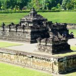
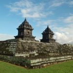
 Banyunibo
Candi Banyunibo (Javanese: ꦧꦚꦸꦤꦶꦧ, translit. Candhi Banyuniba, ‘dropping water’) is a Buddhist temple located not far from Ratu Boko Temple, which is in the eastern part of Yogyakarta City towards Wonosari City. About 5.6 km to the south of Prambanan temple, and administratively located in Cepit Hamlet, Bokoharjo Village, Prambanan District, Sleman, Special Region of Yogyakarta. This temple was built around the 9th century during the Ancient Mataram Kingdom. At the top of this temple there is a stupa which is a hallmark of Buddhism.
This temple building is named Banyunibo Temple which is not far from the Ratu Boko complex, Barong Temple, and Ijo Temple. Even around this temple, there are many temple sites scattered in several surrounding hamlets. This temple was found in a collapsed state and then began to be excavated and researched in the 1940s. This temple was built around the 9th century during the Ancient Mataram Kingdom. Banyunibo Temple is rarely visited by tourists.
At the top of this temple there is a stupa which is a hallmark of Buddhism. The meaning of the name of this temple is banyunibo which means dripping water (in Javanese) although in this temple there are no water droplets or water sources around the temple. Banyunibo Temple is a Buddhist sacred building which is quite rich in ornaments. Almost every part of the temple is filled with various decorations and reliefs, although one part of the temple is often found with the same ornate motif.
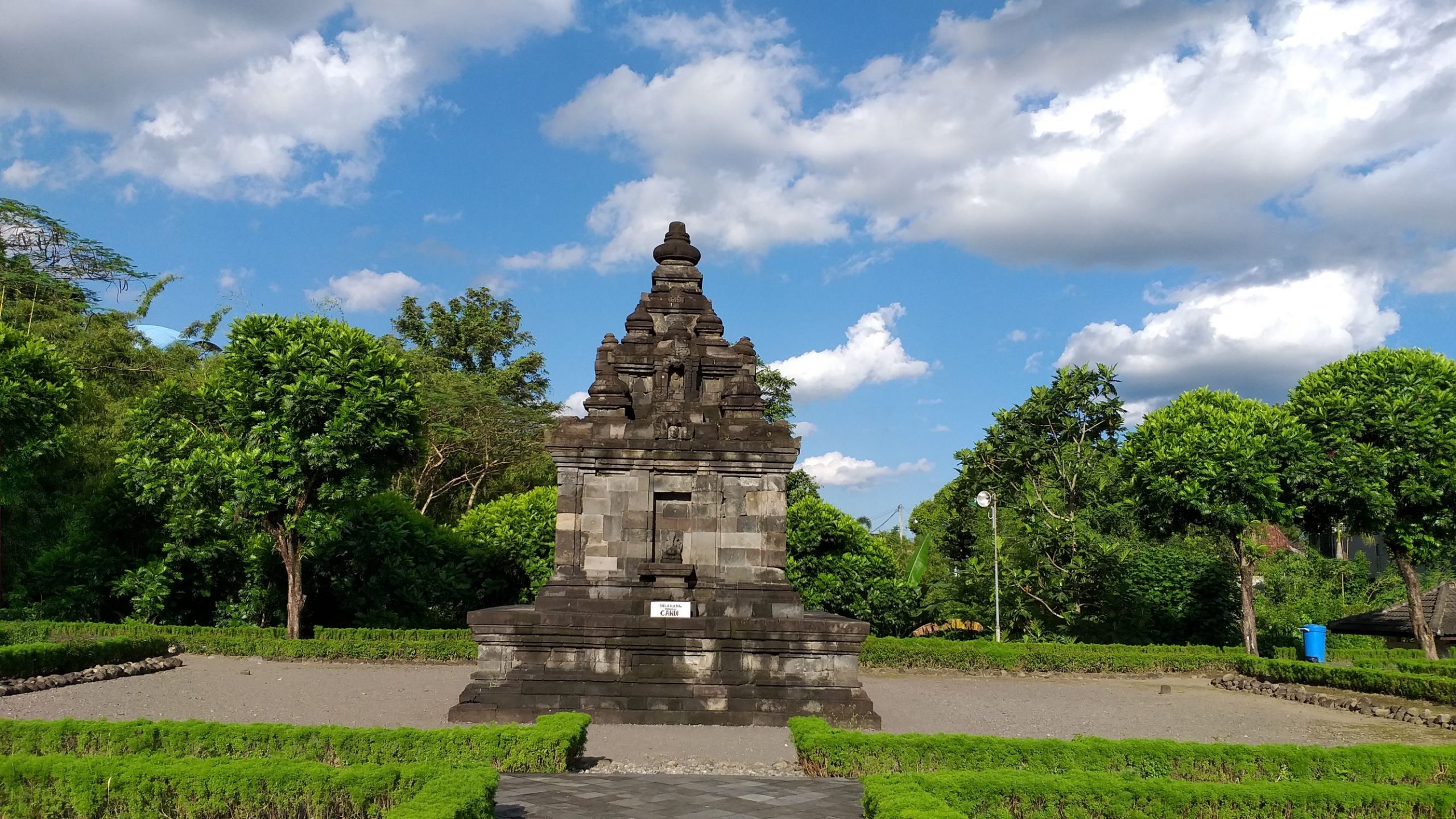 Gebang
Gebang Temple is a temple located in Dusun Gebang, Wedomartani Village, Ngemplak District, Sleman Regency, Special Region of Yogyakarta. This temple was discovered by local residents in November 1936, but it is only a statue of Ganesha. From 1937 to 1939, the Dutch East Indies government carried out a restoration so that the shape of Gebang Temple could be made in its entirety. Gebang Temple was built around 730–800 AD in the early days of Central Java.
Gebang Temple is a square measuring 5.25 meters x 5.25 meters. Its height reaches 7.75 meters. The basic material for making Gebang Temple is andesite stone. The foot of the temple is 2 meters high without any carvings. Gebang Temple has an entrance on the east side with statue niches on the left and right side of the door. The statue niche contains the statue of Nandiswara and the statue of Ganesha. Inside the temple room there are yoni and phallus with a phallus-shaped roof.
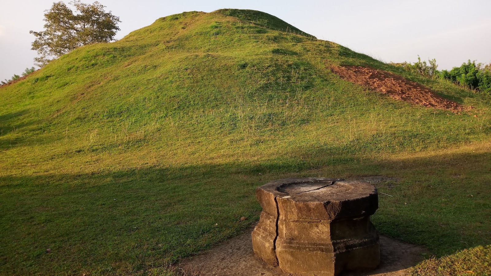
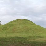
Abang Temple is located not far from Banyunibo Temple and Barong Temple, which is in “Dusun” Candiabang, Jogotirto Village, Berbah District, Sleman, Special Region of Yogyakarta. The place of this temple is also close to Adisucipto Airport. This temple was built around the 9th and 10th centuries during the ancient Mataram Kingdom. However, this temple is thought to have a younger age than other Hindu temples.
This pyramid-shaped temple is called Abang Temple because it is made of red brick (Abang in Javanese). The shape of this temple is in the form of a rectangle with a size of 36 m x 34 meters, now a lot of grass is overgrown so that from a distance it looks like a mound or small hill. When it was first discovered, in this temple there is a statue and a yoni base symbol of Lord Shiva in the shape of a segment (not rectangular, as usual) with a side measuring 15 cm.