
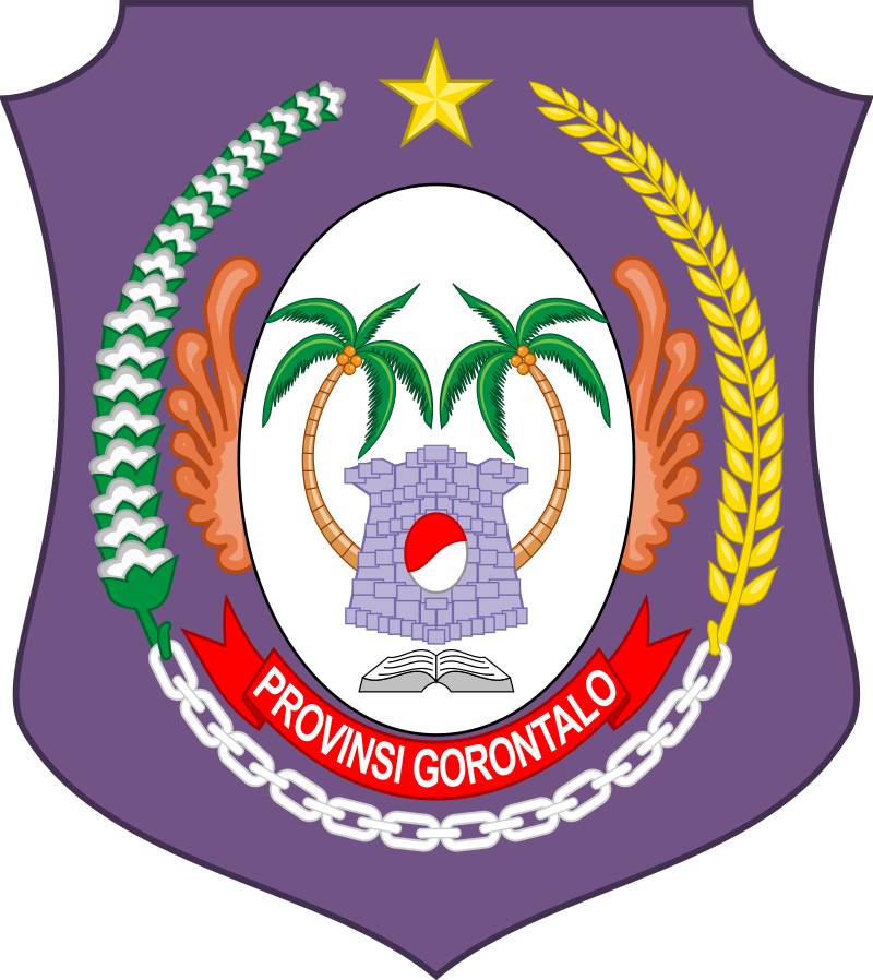
 Gorontalo (Gorontaloan: Hulontalo) is a province of Indonesia on the island of Sulawesi. Located on the Minahasa Peninsula, Gorontalo was formerly part of the province of North Sulawesi until its inauguration as a separate province on 5 December 2000.
In Indonesian history, the only Indonesian President from the Gorontaloan people is the third President of the Republic of Indonesia, Prof. DR. Ing. Bacharuddin Jusuf Habibie. His father, Alwi Abdul Jalil Habibie, comes from the “Habibie” clan.
 The Origin of Gorontalo
The word Gorontalo comes from the word Hulontalo in the Gorontalo language. Hulontalo is derived from the word Hulontalangi, a name of one of the Kingdoms in Gorontalo. In addition, there are several historical records regarding the origin of the name Gorontalo, including: a. Gorontalo comes from the word “Hulontalangi”, which means “Valley of the Noble”. Hulontalangi comes from two syllables, namely “Huluntu” which means “Valley” and “Langi” which means “Noble”.
 b. Gorontalo comes from the word “Hulontalangi”, which means “Inundated Land”. The word “Hulontalangi” in other translations comes from two syllables, namely “Huntu” which means “Piles of Soils” or “Mainland”, and “Langi-Langi” which means “Flooded”. Then the word “Hulontalangi” can also be interpreted as “Flooded Land” according to the story of the people of Gorontalo.
c. Gorontalo comes from the word “Huidu Totolu”, which means “Three Mountains”. If traced its history, there are three ancient mountains on the Gorontalo peninsula, namely Mount Malenggalila, Mount Tilonggabila (changed to Tilongkabila) and another Mountain which is not named.
 d. Gorontalo comes from the word “Pogulatalo”, which means “Place of Waiting”. The word “Pogulatalo” gradually changed in the words of the community to “Hulatalo”
e. Gorontalo comes from the word “Hulontalo”. However, due to difficulties in pronunciation, the Dutch colonizers called “Hulontalo” to be “Gorontalo”.
 Gorontaloans sometime refer themselves as Hulandalo or Hulantalo, a well-known term in Gorontalo and North Sulawesi, which usually refer to the region of Gorontalo or the native people from Gorontalo.
Pohala’a
The Gorontaloan people also have a family kinship system called Pohala’a. This system is a heritage of the kingdoms that had previously established in Gorontalo. There are five pohala’a in Gorontalo, namely Gorontalo, Limboto, Suwawa, Bualemo and Atinggola; where the Gorontalo pohala’a is the most prominent among the pohala’as.

 History
Historically, Gorontalo has been the center for the spread of Islam in Eastern Indonesia, dating back to the pre-colonial era. The province also was the seat of many independent Gorontaloan kingdoms. The Dutch arrived in the beginning of the 17th Century, subjugating the local kingdoms and finally annexed the area into the Dutch East Indies. Gorontalo was briefly occupied by the Japanese during World War II, before finally becoming part of the independent Republic of Indonesia.
 Gorontalo was incorporated into the province of North Sulawesi, but after the Fall of Suharto, the government decided to create a new province, owing to the cultural and religious differences to the Christian-majority province of North Sulawesi and also as part of the country’s decentralization program. Hence, the new province was created on 5 December 2000.
Compared to other provinces of Indonesia, Gorontalo is one of the least developed provinces. As of 2017, Gorontalo scores 0.670 in Human Development Index, one of the lowest in Indonesia. It ranks 28th out of the 34 provinces. Compared to the neighbouring provinces such as North Sulawesi, Gorontalo’s infrastructure is very poorly developed. The province has often suffered from electricity crises as well as water shortages. Nevertheless, the government is currently attempting to improve Gorontalo’s infrastructure, with construction projects such as the Gorontalo Outer Ring Road, Randangan Dam and the Anggrek Power Plant.
 Geography
Gorontalo lies on the northern arm of Sulawesi Peninsula, also known as the Minahasa Peninsula. The province has an elongated shape area, stretching from west to east almost horizontally on a map, with a total area of 11,257.07 km2 (4,346.38 sq mi). To the north and the south of the province lies the Sulawesi Sea and the Gulf of Gorontalo or known as Gulf of Tomini, respectively.
 Prior to 2000, Gorontalo province was part of North Sulawesi province which lies on the eastern border. The western border of the province is Central Sulawesi province.
Topographically, the province is relatively low (0–40o), with the elevation ranging between 0–2,400 m (7,900 ft) above sea level. Its coastline length is more than 590 km (370 mi). Counting the Exclusive Economic Zone to the north where Philippines is at the border, the total sea area of the province is more than 50,500 km2 (19,500 sq mi). There are some small islands around the north and the south of the province, 67 of which have been identified and named.
 The land surface in Gorontalo Province is mostly hilly. Therefore, the province has many mountains with different heights. Tabongo Mountain which is located in Boalemo Regency is the highest mountain while Litu-Litu Mountain which is located in Gorontalo Regency is the lowest.
Besides having many mountains, Gorontalo Province is also crossed by many rivers. The longest river is the Paguyaman River located in Boelemo Regency with a flow length of 99.3 km. While the shortest river is the Bolontio River with a flow length of 5.3 km located in North Gorontalo Regency.
 With the condition of Gorontalo Province which is located near the equator, making this area has a fairly hot air temperature. The minimum temperature occurs in September which is 22.8 °C. While the maximum temperature occurs in October with a temperature of 33.5 °C. In 2013 the average temperature ranged from 26.2 °C to 27.6 °C.
Gorontalo Province has relatively high air humidity, the average humidity in 2013 reached 86.5% percent. Whereas the highest rainfall occurs in May, which is 307.9 mm but the highest number of rainy days is in July and December, which is 24 day

 Demographics
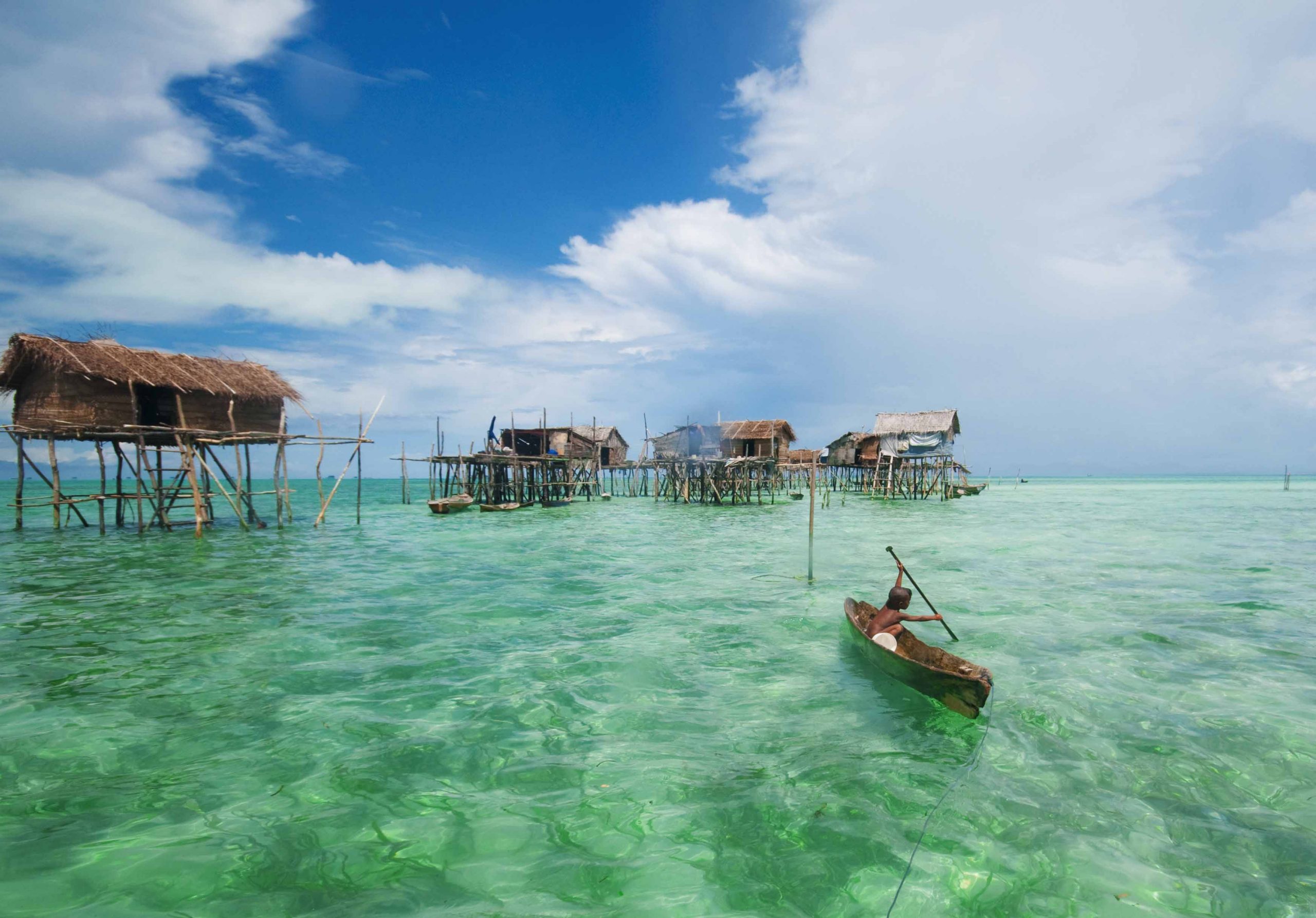
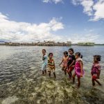
Ethnicity. The Gorontaloan people forms the majority of the population in the province. They are spread from North Sulawesi in the east towards Central Sulawesi in the west. The Sama-Bajau people are sea nomads, and they lived in villages at the coast of Gorontalo. Other ethnic groups are mostly immigrants from other parts of Indonesia, such as the Javanese and the Bugis.
Religion. Like many Indonesian provinces, Islam is the majority religion adopted by the people of Gorontalo. Based on the 2021 population census, 98,02% were adherents of Islam.
 Christians form the second-largest population in Gorontalo. Most Christians are immigrants from North Sulawesi as well as other parts of Indonesia. They form 2.19% of the population. There are other religions such as Hinduism and Buddhism which is mostly embraced by immigrants from other parts of Indonesia.
Language. Indonesian is the official language of the province as well as the country. However, Gorontaloan language is the most spoken language in the province. Apart from Gorontaloan language, there are several languages that are similar which are considered by linguists as Gorontaloan dialects include Suwawa language, Atinggola language, Limboto language, Kwandang language, Tilamuta language and Sumawata language. Local content education in Gorontalo Language is still being maintained as teaching material in elementary schools.
 Culture
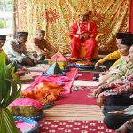
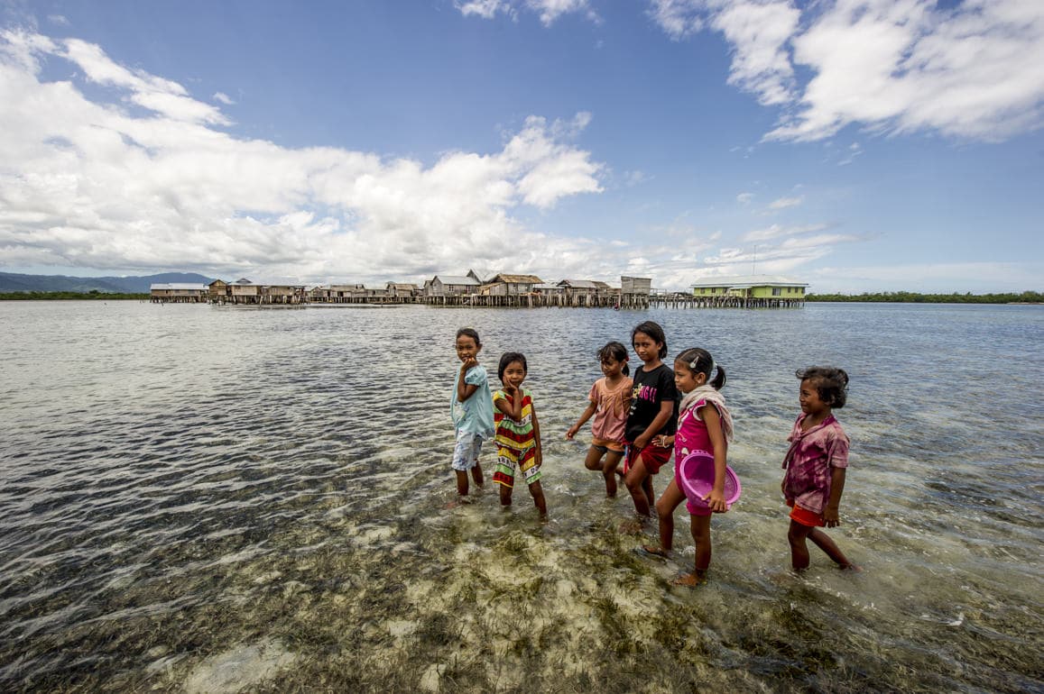
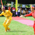
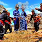
We can also see the distinctive characteristics of Gorontalo in the cultural aspects, including; typical foods, traditional houses, arts, and handicrafts such as filigree or woven basket skullcaps made of rattan called karanji upiya. The Gorontaloan people also recognize various ceremonies as traditions, such as the traditional ceremony of opening fields or known as Momuo Oayuwa, a ceremony for soil fertility known as Mopoahuta. The ceremony to request rain is called the Mohiledidi.
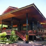
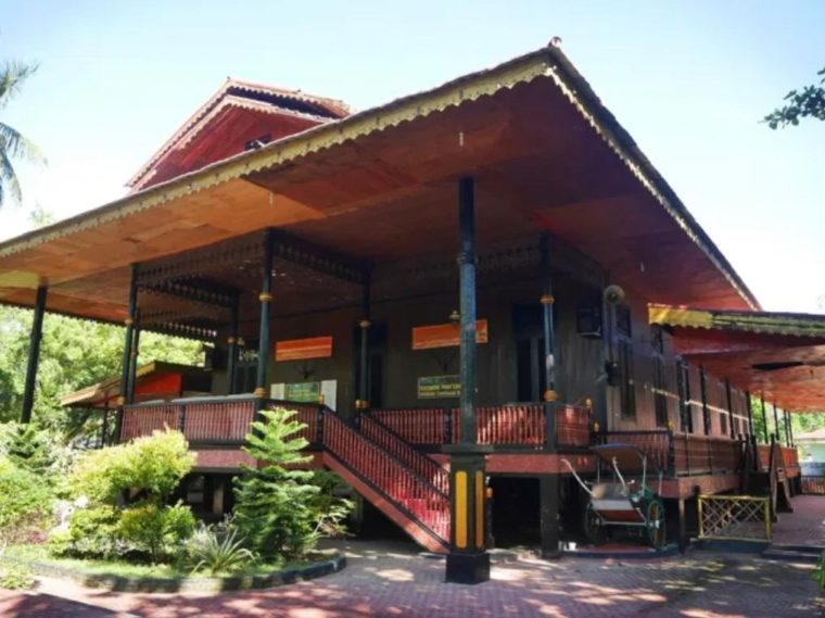 Gorontalo has many types of Traditional Houses that are characteristic of the province, including the Dulohupa traditional house located in Gorontalo City and the Bandayo Poboide traditional house in Limboto.
Dulohupa. In Gorontaloan language, Dulohupa means “Consensus”. The name is in accordance with the functions of this traditional house which is often used to deliberate to reach consensus in traditional cases during the reign of Gorontalo kings in the past. Dulohupa’s house is also used as a place to try someone who commits a crime.
 Handycrafts. Gorontaloan society has a characteristic “sandang” or clothing with accessories that complement it. The typical handicrafts of the people of Gorontalo are:
– Upiya Karanji or Songkok Gorontalo, this songkok is made of rattan woven and is very comfortable to use because it has very good air circulation. The 4th President of Indonesia, Abdurrahman Wahid, or better known as Gus dur, was known to often use Gorontalo Songkok.
 – Sulaman Karawo or Sulaman Kerawang, Gorontalo’s unique embroidery is a distinctive cultural property and of high artistic value. Now Karawo’s embroidery is not only in demand in the country but also abroad.
– Gorontalo Batik. Gorontalo Batik is basically the same as Batik in general, which distinguishes it only from the motifs or patterns contained in the batik cloth itself.
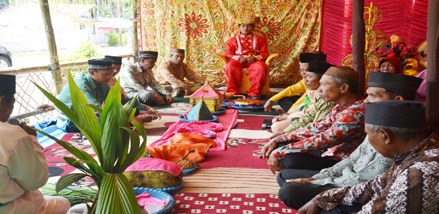
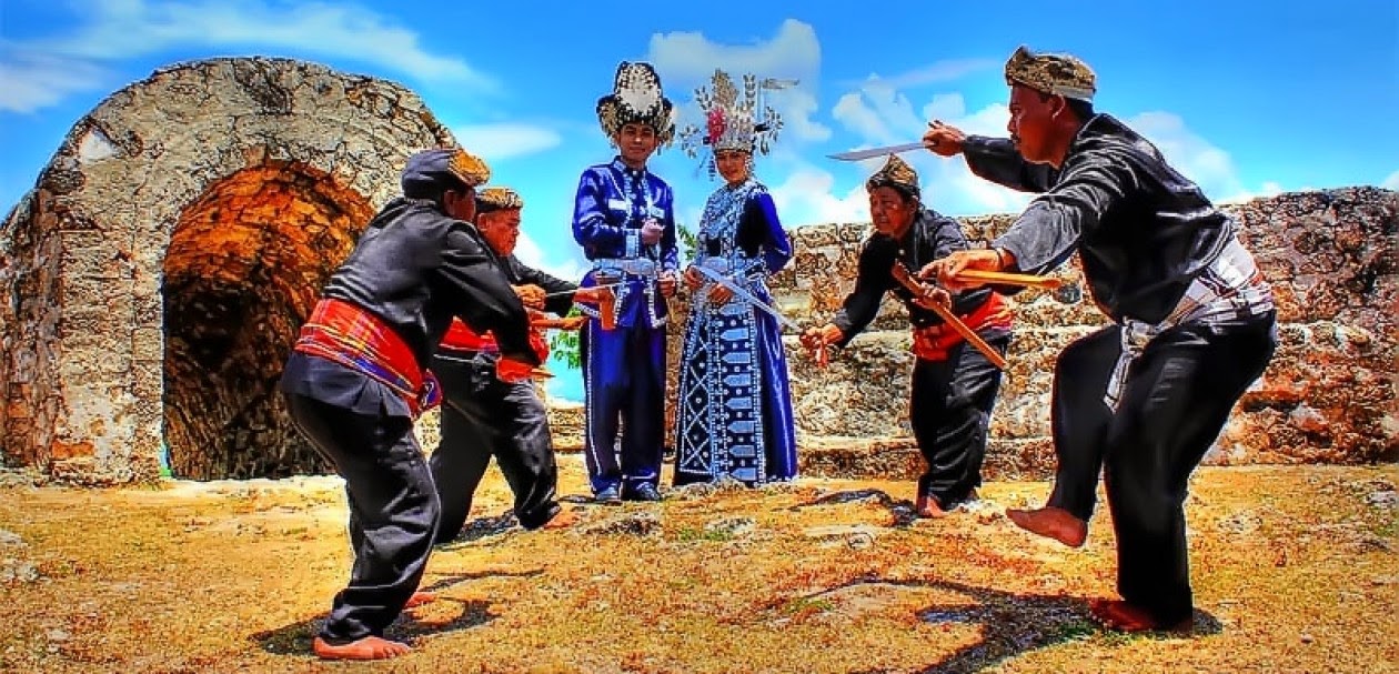
Martial Art. Gorontalo also has a traditional martial arts called “Langga” or it can be called Silat Gorontalo. Basically, Langga is a martial arts type of Silat which is known as one of Gorontalo’s cultural riches. Langga is a martial art that relies on defense and strength of hands and feet.


 Tourism
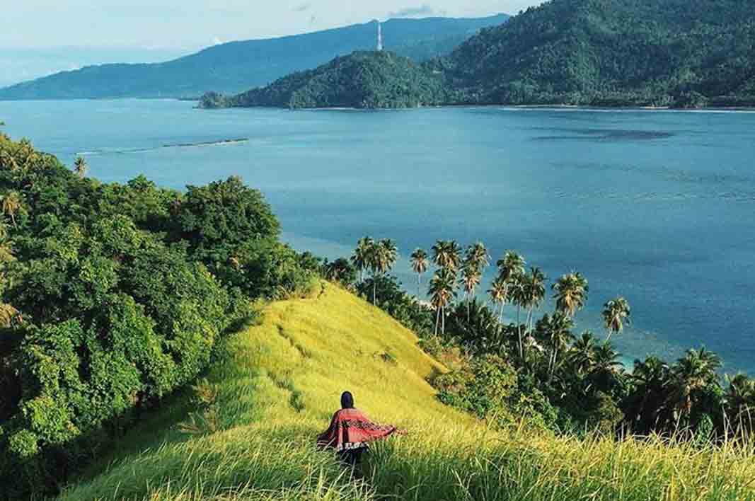
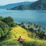
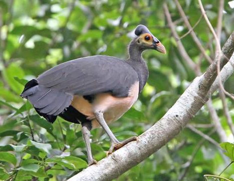
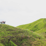
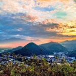
Gorontalo consists mostly of mountainous areas that stretch from north to south of the province. The Gorontaloan mountains and forests are homes for unique flora and fauna. Anoa, Tarsius, Maleo, and Babirusa are among the rare species that can be found here.
Maleo, for example, is a bird species whose eggs are larger than their own body. While Tarsius is the smallest primate in the world, but has a length of about 10 cm. Examples of trees native to Gorontalo are Ebon, Lingua, Nantu, Meranti, and Rattan Trees.
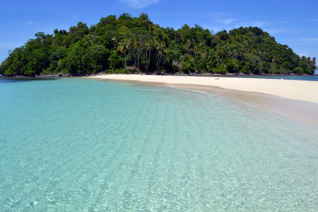
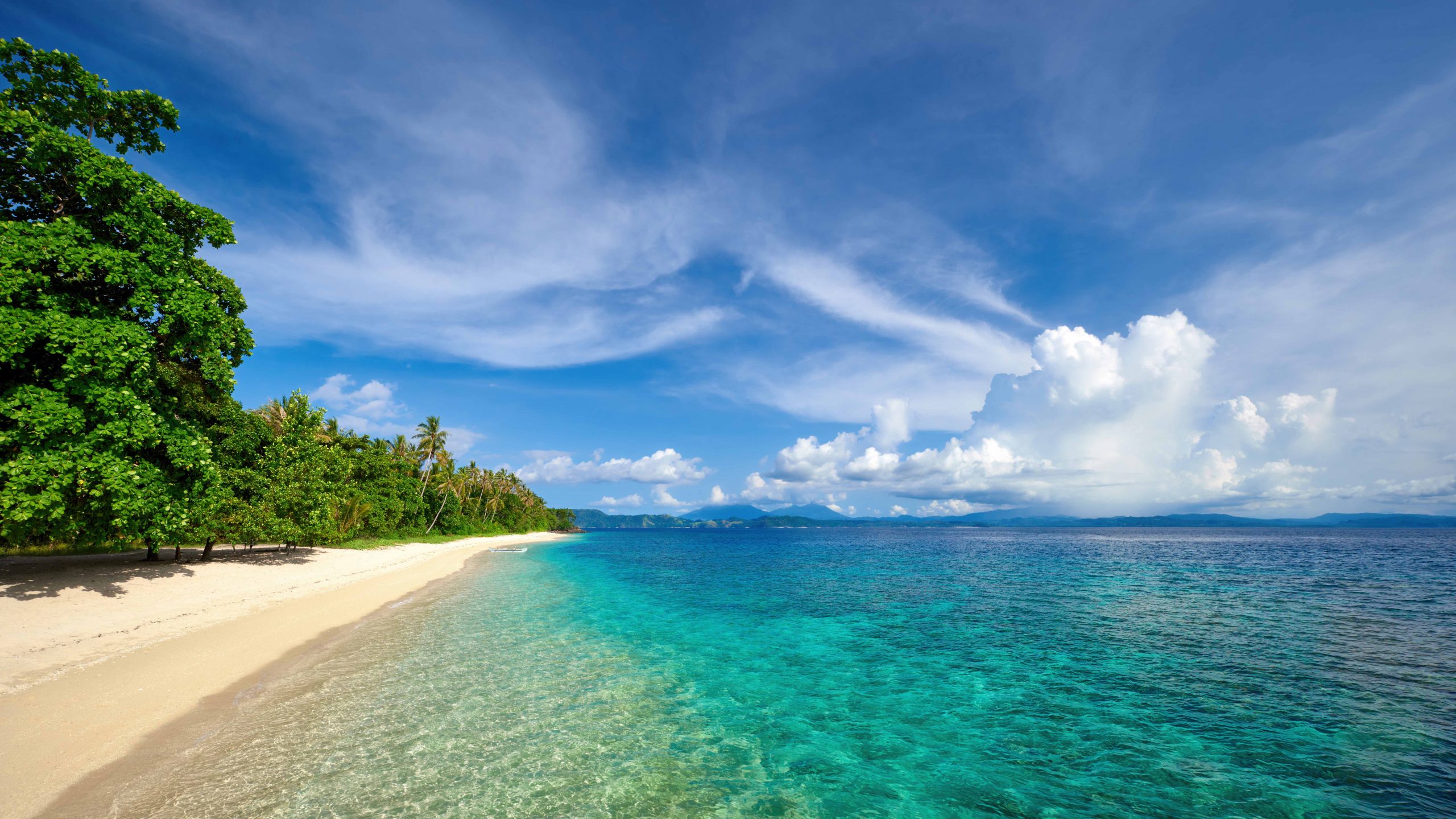
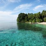
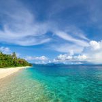
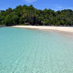
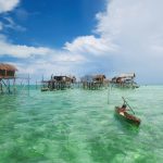
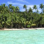
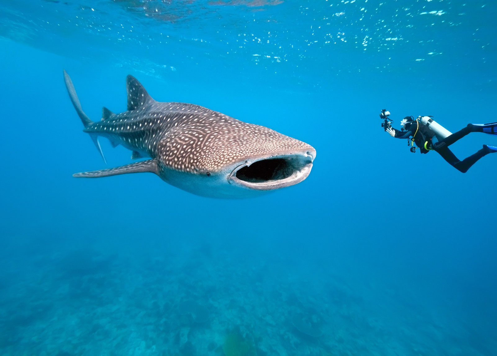
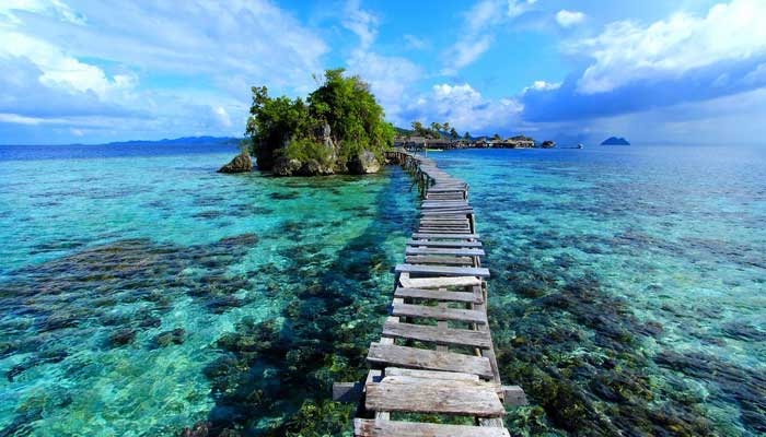
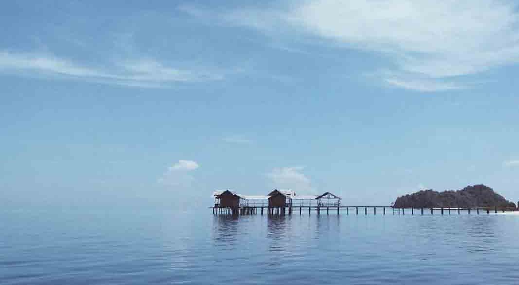
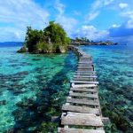
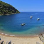
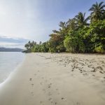
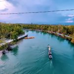
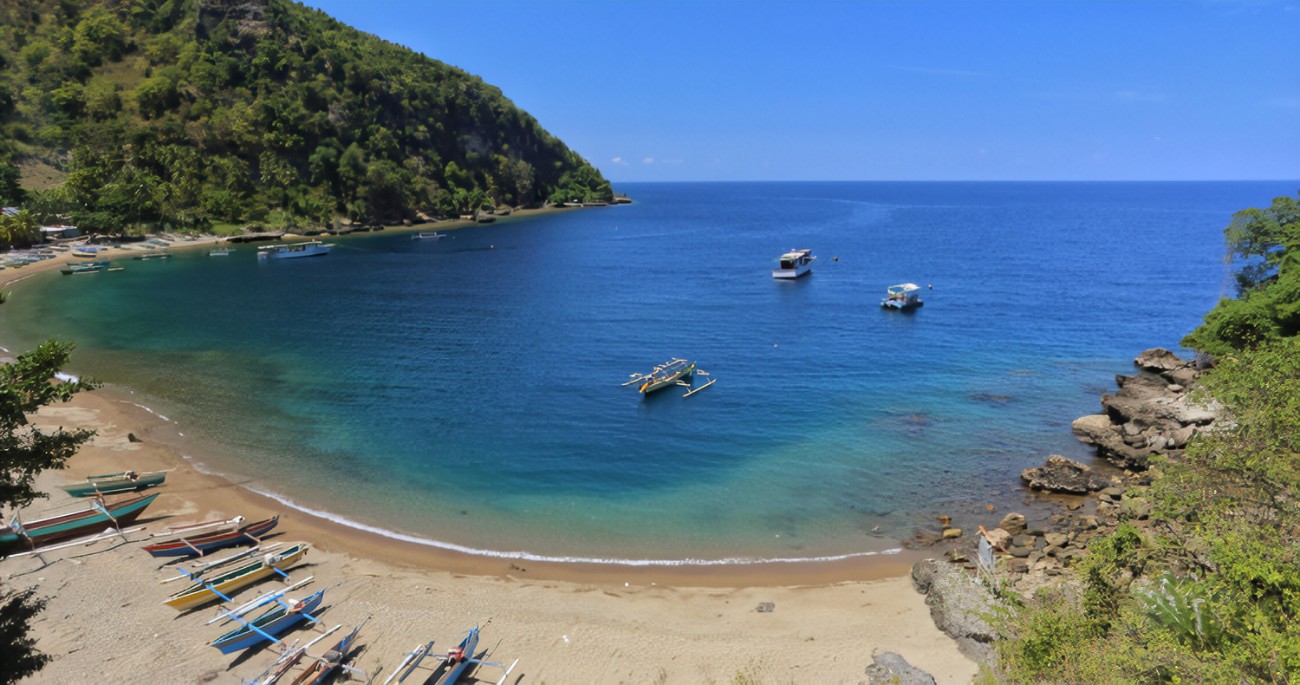 In the southern part of Gorontalo, namely in the Gulf of Tomini, there are several small islands and uninhabitedscattered. Tomini Bay is crossed by the equator and is naturally inhabited by various types of marine animals. Because of this, Gulf of Tomini is a paradise for divers. Tourist spots in Gorontalo include the following:
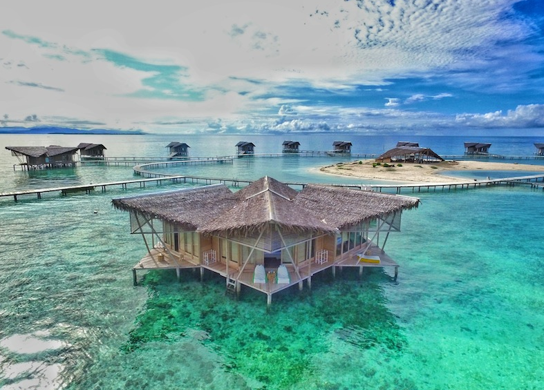
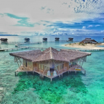
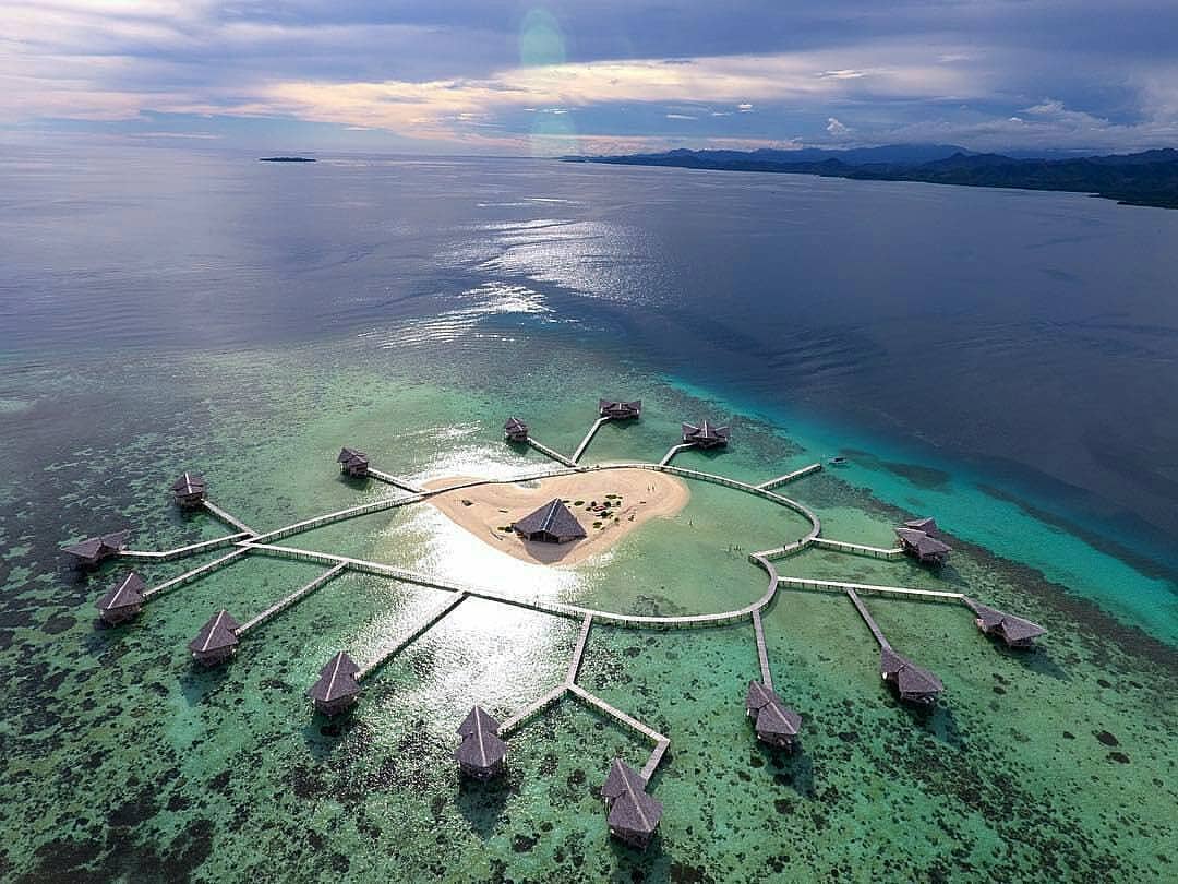
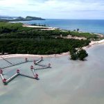
Pulo Cinta or “Love Island” in English is located in Boalemo Regency. This heart-shaped island is equipped with several very exclusive floating resorts, and certainly shows the exoticism of the charming clear sea. Pulo Cinta has become a destination for both local and foreign travelers, and often dubbed as “Maldives van Gorontalo”.
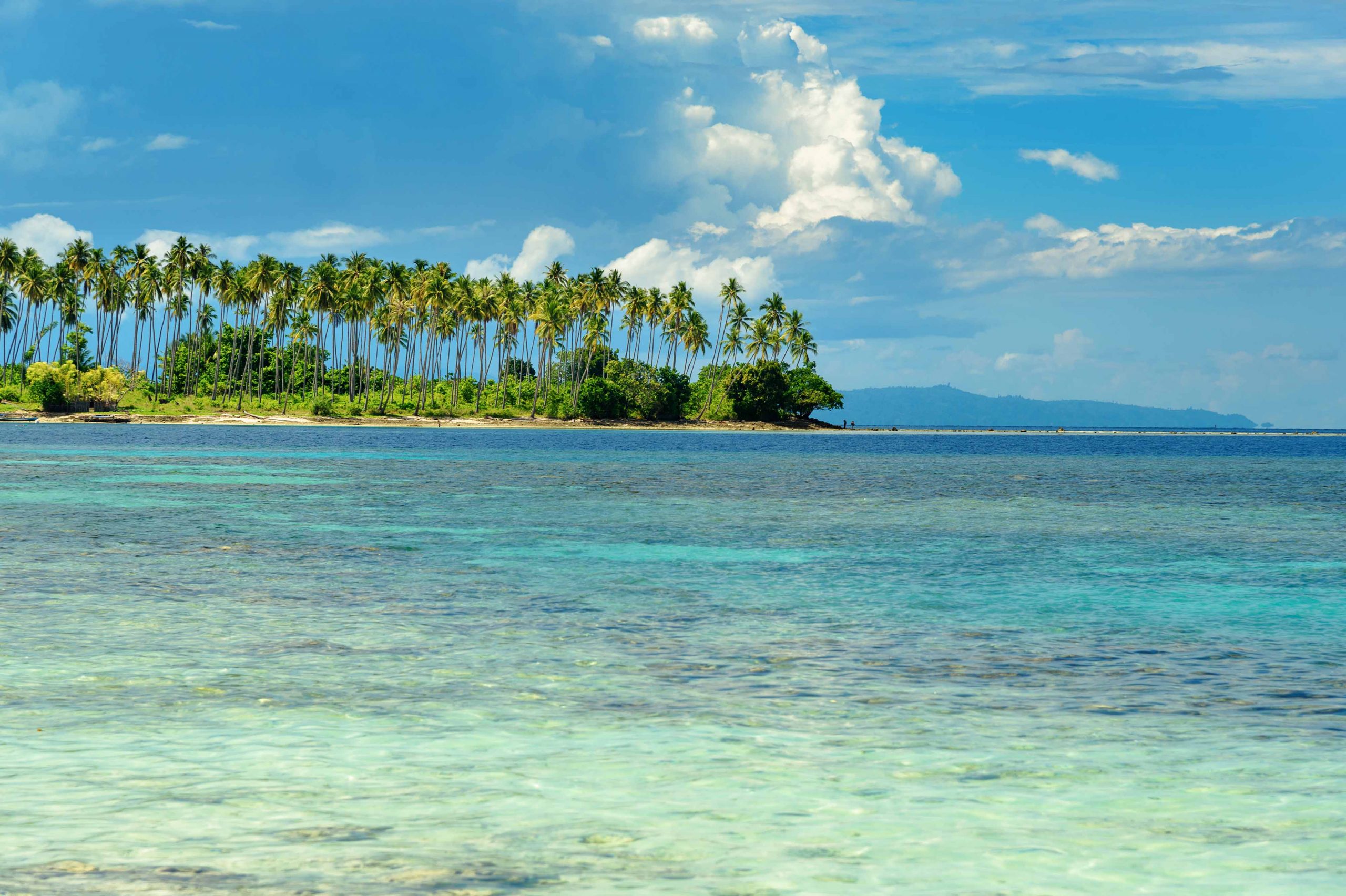
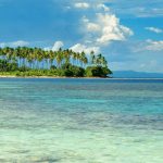
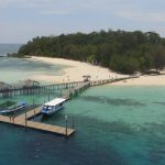
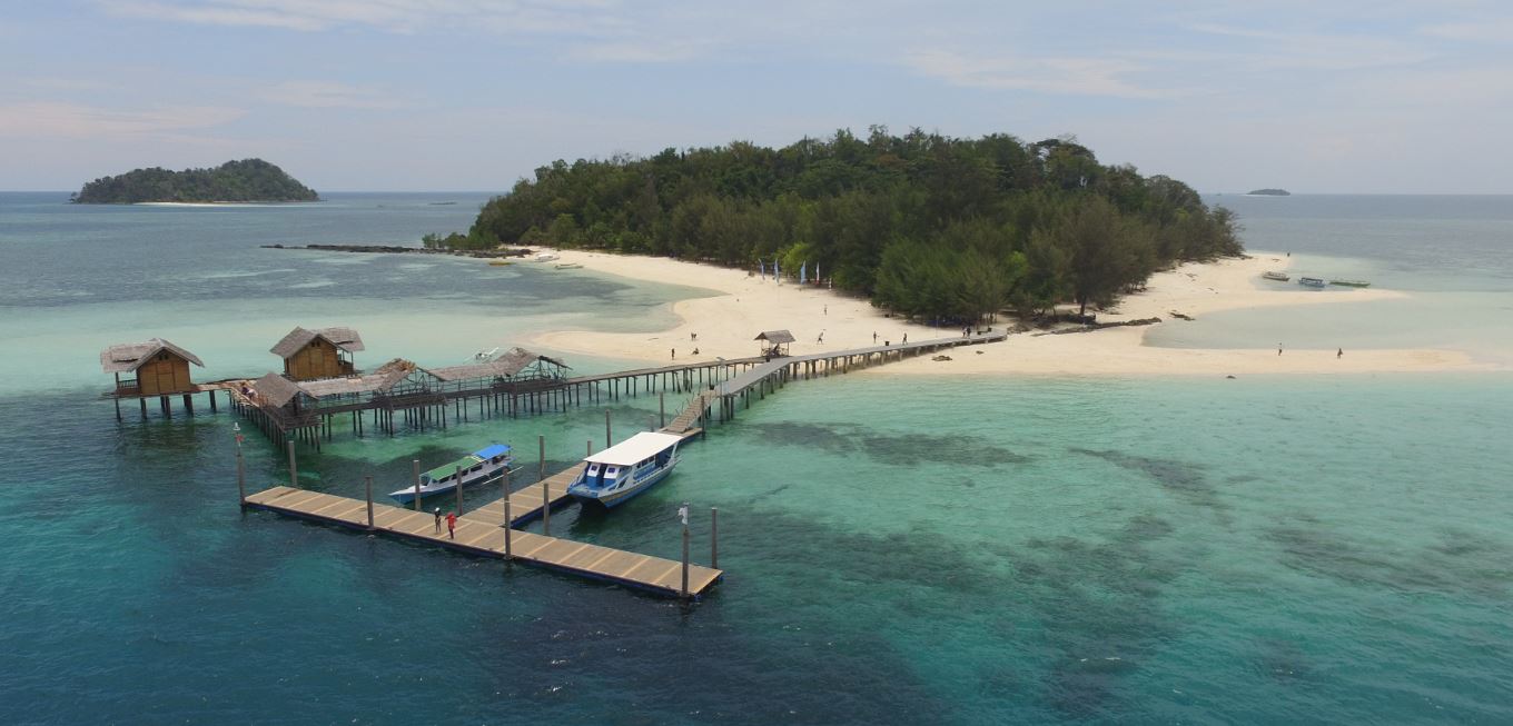 Saronde Island is Indonesia’s flagship International Tourism in Gorontalo Province, located in Kwandang, North Gorontalo. Saronde Island is known for its white sand beaches, clear water and its surrounding coral reefs. Every year, this island is a stopover for yachts from all over the world. In addition to Saronde, there are 3 other nearby islands, namely Bogisa, Mohinggito, and Lampu islands.
Olele Marine Park is one of the leading International Underwater Paradise of foreign divers in Bone Bolango Regency. This marine park is also well known to European divers. Olele Marine Park is famous for the uniqueness of Salvador Dalí Sponge, a species of sponge that cannot be found in any other marine parks in the world, even the marine park on Bunaken National Park in North Sulawesi does not have this type of sponge. This sponge is named Salvador Dalí because its physical appearance resembles a painting by Salvador Dalí.
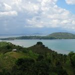
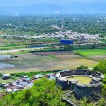
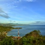
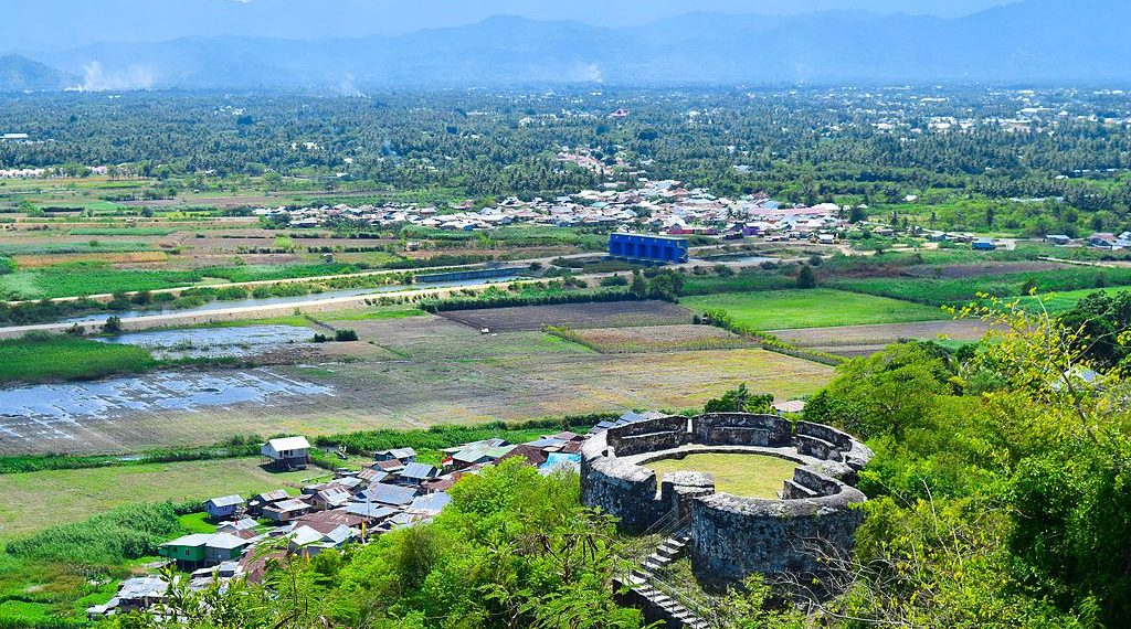 Fort Otanaha. In the past this was a legacy of former Portuguese colonization. Fort Otanaha, used by the Gorontalo Kings as a place of protection and defense. The uniqueness of the visible fort is the material used to build a mixture of sand, plaster, and egg white forts.
The view of Lake Limboto can be seen clearly from here, because it is located on a plateau. Precisely, in Dembe I, Kota Barat, about 8 km from downtown Gorontalo. There are two more forts located in the same area, namely Otahiya and Ulupahu Palace. Visitors must pass 345 steps to reach it.
Lake Limboto is a large lake located in Gorontalo Regency. The lake with an area of around 3,000 hectares is the estuary of five major rivers, namely the Bone Bolango River, Alo River, Daenaa River, Bionga River and Molalahu River.
Boalemo
Bone Bolango
Gorontalo
Gorontalo Utara
Pohuwato
Gorontalo