 East Nusa Tenggara (Indonesian: Nusa Tenggara Timur – NTT) is the southernmost province of Indonesia. It comprises the eastern portion of the Lesser Sunda Islands, facing the Indian Ocean in the south and the Flores Sea in the north. It consists of more than 500 islands, with the largest ones being Sumba, Flores, and the western part of Timor; the latter shares a land border with the separate nation of East Timor. The province is subdivided into twenty-one regencies and the regency-level city of Kupang, which is the capital and largest city.
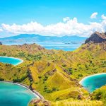
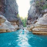
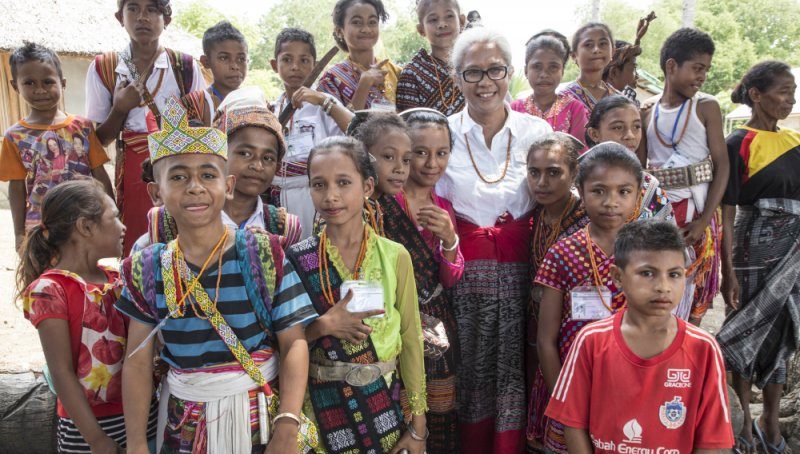
A Christian-majority region, East Nusa Tenggara is the only Indonesian province where Roman Catholicism is the predominant religion. The province has a total area of 47,931.54 km2 and a population of 5,325,566 (2020 Census). Economically, East Nusa Tenggara still remains one of the least developed provinces in Indonesia. It currently focuses on expanding the tourism sector, with the most well-known attractions including Labuan Bajo, Komodo National Park, and Mount Kelimutu.
 Geography
Located in the east of Lesser Sunda Islands, East Nusa Tenggara faces the Indian Ocean in the south and the Flores Sea in the north. The province is bordered by other provinces, in the west by West Nusa Tenggara and in the east by East Timor and southern part of Maluku.
The province consists of about 566 islands, the largest and most dominant are Flores, Sumba, and the western part of Timor. The smaller islands include Adonara, Alor, Komodo, Lembata (formerly called Lomblen), Menipo, Raijua, Rincah, Rote Island (the southernmost island in Indonesia), Savu, Semau, and Solor.
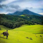
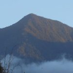
The highest point in the province is Mount Mutis in the South Central Timor Regency, 2,427 meters above sea level.
 Demographics
The Census population of the province was 4,683,827 in 2010 and 5,112,760 in 2015, but the most recent estimate was 5,456,203 (as at mid 2019).
The secondary school enrolment rate of 39% is dramatically below the Indonesian average (80% in 2003/04, according to UNESCO). Lack of clean drinking water, sanitation, and health facilities means that child malnutrition (32%) and child mortality (71 per 1000) are higher than in most of the rest of Indonesia.
Maternal and infant mortality are high partly because of poor access to health facilities in isolated rural areas. Malaria is a significant problem in parts of the province with the result that the rate of infant mortality caused by malaria, in recent years, has been the highest across Indonesia.


 Agriculture
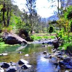
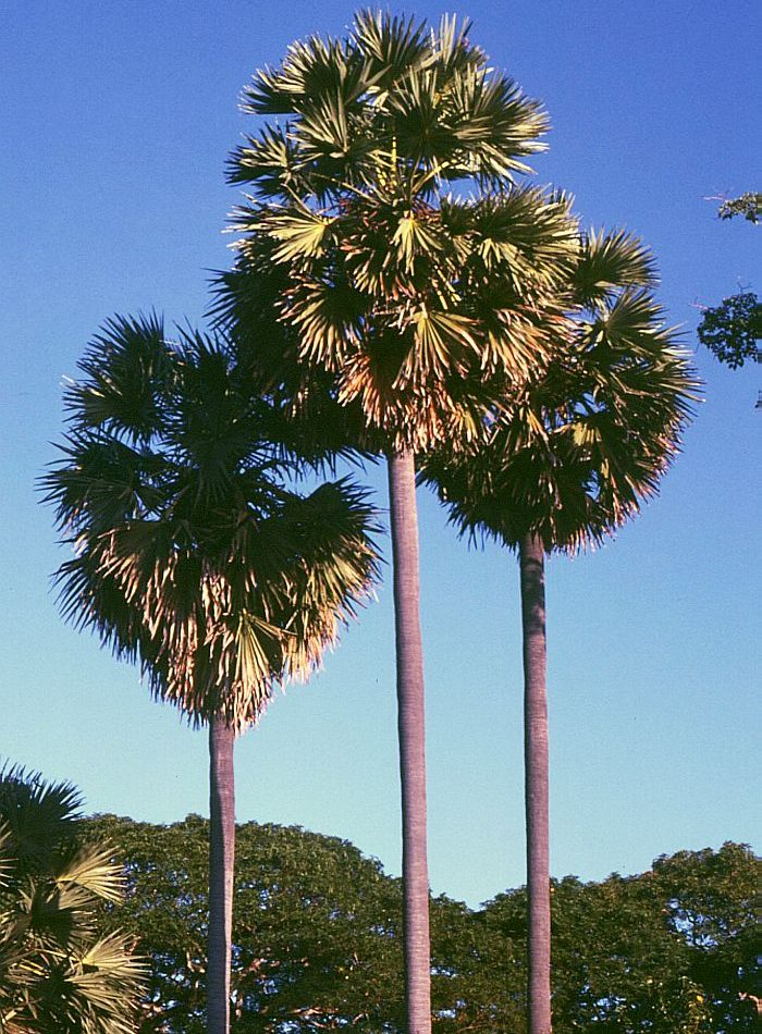
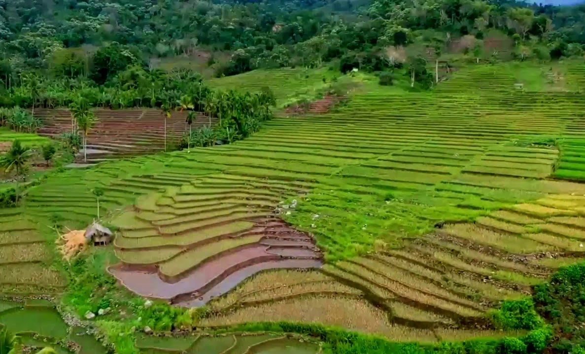
The main part of the economic activity in the province is subsistence agriculture. Important local crops include corn and some smallholder plantation crops such as coffee. In some places such as Sumba, the lontar palm (Borassus flabellifer) dominates local agricultural activities and is a very important part of the local economy. In these areas, the lontar palm provides timber and thatching as well as food in the form of fruits, and palm sugar which is obtained by tapping the fruit stems.
The sugary sap can be used to make alcoholic drinks. In other parts of the province such as West Manggarai, the sugar palm (Arenga pinnata) has a useful role in the local economy. The degree of mechanization in agriculture is low. Large animals (buffaloes, horses) are widely used throughout the province.
 Natural resources
A significant part of the economic activity in the province involves the development of natural resources, including forestry and numerous local mining ventures. Some of the activity is controversial, however, because regulatory controls over the use of natural resources are not always effective. There have been disputes in some areas over the use of land. Manganese mining, for example, in the central part of the island of Timor has been controversial. Nearby, in the Mount Mutis area to the east of Kupang, amongst some local groups there is a concern at the way local resources are being developed by mining companies.
 There is also significant activity in the informal mining sector. Across the province, villagers sometimes exploit localized opportunities to undertake unregulated mining or mineral-based projects. In West Timor, for example, in the South Central Timor Regency, villagers living near the south coast in the Kolbano area south of the town of Soe sometimes collect colored stones which, in turn, are sold to companies that export the stones to countries such as Australia, China, Malaysia, Singapore, and elsewhere.
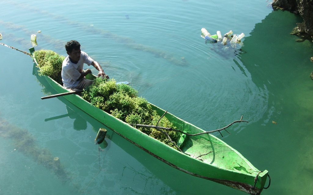
The cultivation of seaweed is an important activity in some parts of the province. In the Alor Islands, for example, village-based informal cultivation of seaweed helps boost local incomes. Much of the seaweed is exported in unprocessed form, including to countries such as Japan in north Asia. One view is that more needs to be done to encourage further domestic processing of the seaweed to add value before export; however, the local skills and facilities for further processing are not well-developed and it is not clear that a program to encourage further processing would be successful.
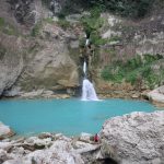
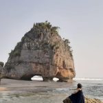
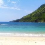
Tourism
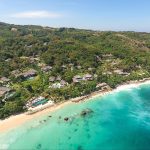
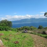
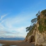
 The provincial government aims to promote tourism. There are various interesting locations in the province. The basic infrastructure to support the tourist sector (such as transport facilities, accommodation, and adequate and reliable information) needs to be strengthened but several main features of the tourist sector in the province include:
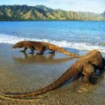
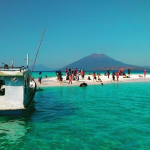
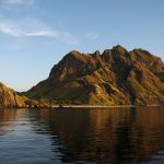
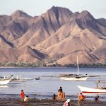
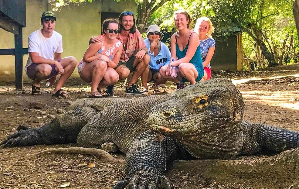
+ Komodo Island in Komodo National Park, with the well-known Komodo dragon
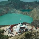
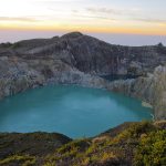
+ Kelimutu volcano on Flores which contains 3 striking crater lakes of varying colors
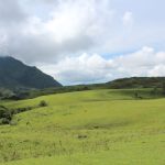
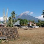
+ Mount Mutis to the east of Kupang, the highest point in the province and an area known for hiking & bird-watching
+ Semana Santa in Larantuka
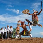
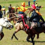
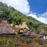
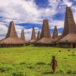
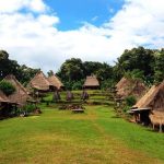
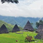
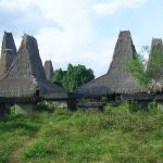
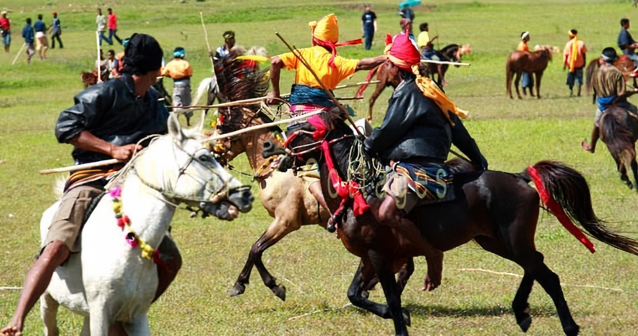
+ Traditional housing and pasola in Sumba Island
+ Alor Dive in Alor Island
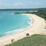
Nemberalla Beach in Rote Ndao
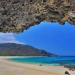
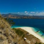
Pink Beach in Padar island
+ Taman 17 in Riung Island.
 In 2016 East Nusa Tenggara was awarded 6 medals from 10 categories listed in the Anugerah Pesona Indonesia 2016. These were:
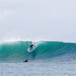
+ Most popular surfing spot: Nemberala Beach, Rote Ndao Regency
+ Most popular cleanliness spot: Nihiwatu Beach, West Sumba Regency
+ Most popular of the historical site of Ende: Bung Karno (Indonesia’s proclaimer and first Indonesia’s President) Site
+ Most popular diving site: Alor Island, Alor Regency
Most popular attraction: Pasola, Southwest Sumba Regency
+ Most popular highland area: three different color lakes/calderas at Mount Kelimutu, Ende.
Various local community groups in the province work to promote the local tourist industry although, as yet, many of these activities are still somewhat underdeveloped and need strengthening.